As firefighters continue battling devastating wildfires in central Spain, the European Space Agency’s Cebreros deep-space ground station escaped damage and safely resumed operations.
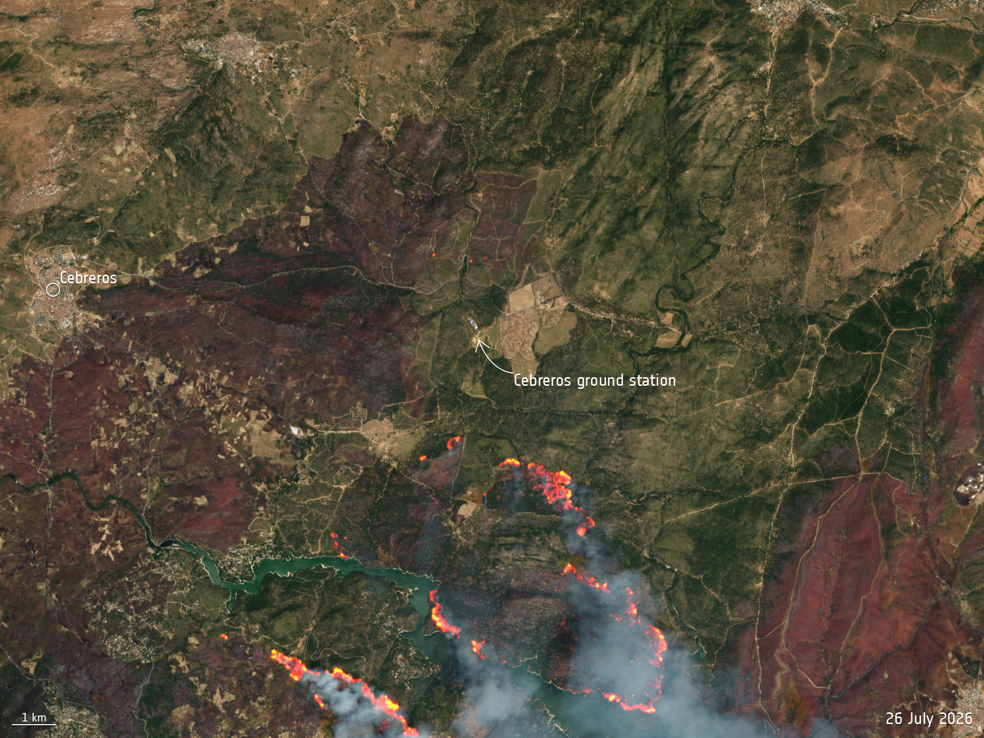
This Copernicus Sentinel-2 image, acquired on 26 July, shows the area surrounding the station, where active fire fronts are highlighted using a combination of true-color and false-color imagery. Located about 77 km west of Madrid, the station’s 35-meter antenna is part of ESA’s deep-space tracking network, supporting missions including Mars Express, Solar Orbiter, JUICE, Euclid, Gaia, and BepiColombo.
The station was evacuated after wildfires came dangerously close. The Spanish government declared a national emergency as fires spread rapidly through the province of Ávila and neighboring Madrid. While inspections confirmed that the facility remained undamaged and operations resumed on 27 July, many nearby communities continue to face the impacts of the fires, with more than 90,000 people evacuated from the region.
The Copernicus Emergency Mapping Service was activated to provide emergency mapping products that help authorities monitor the evolving situation and support response efforts. The image is a reminder of the critical role Earth observation plays — not only in tracking disasters as they unfold, but also in helping protect communities, critical infrastructure, and the people working on the front lines.
A wider view of the area affected by the wildfires was also captured by Sentinel-2 on the same day.
Get more info here.