Image of the Week | Archive

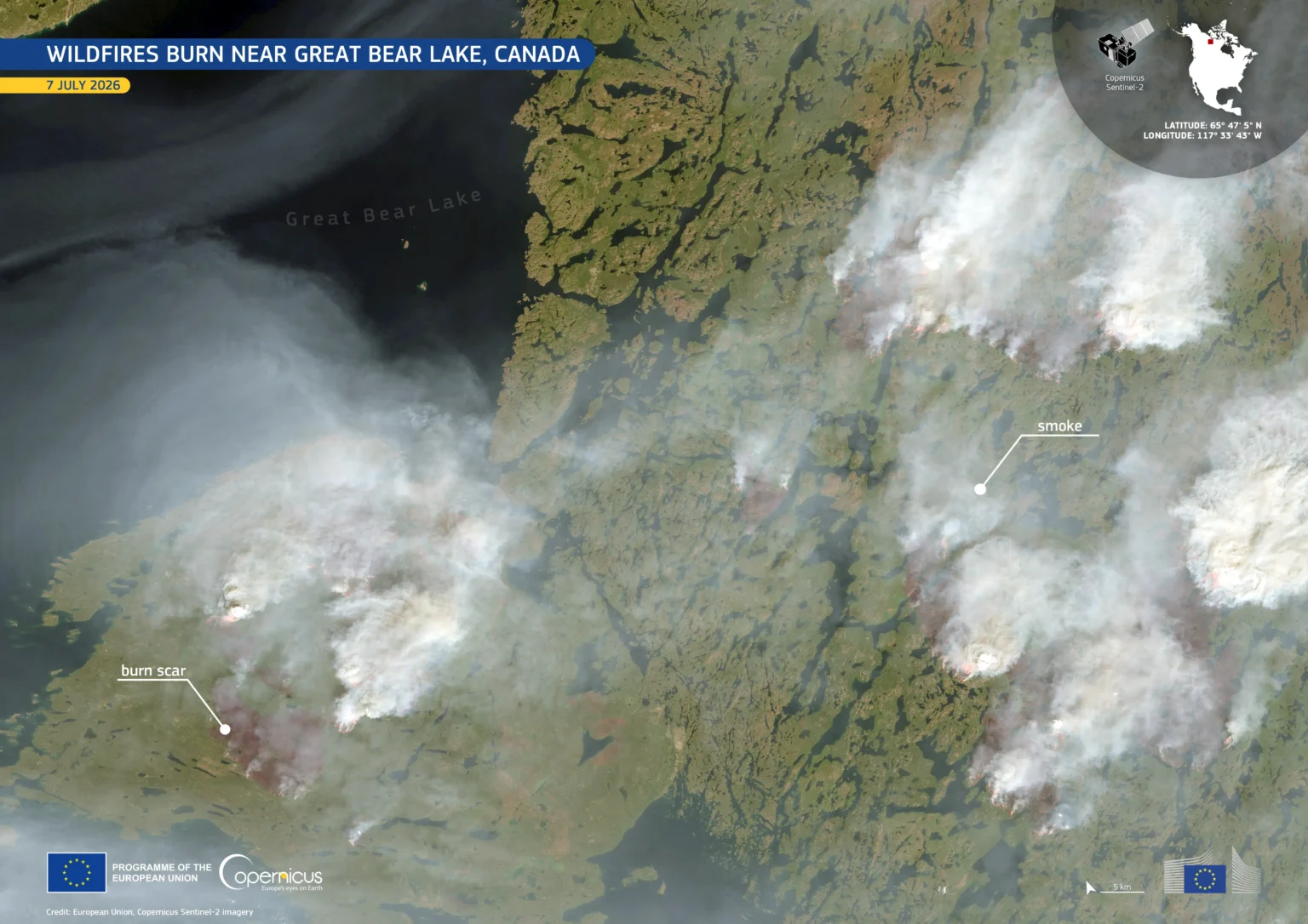
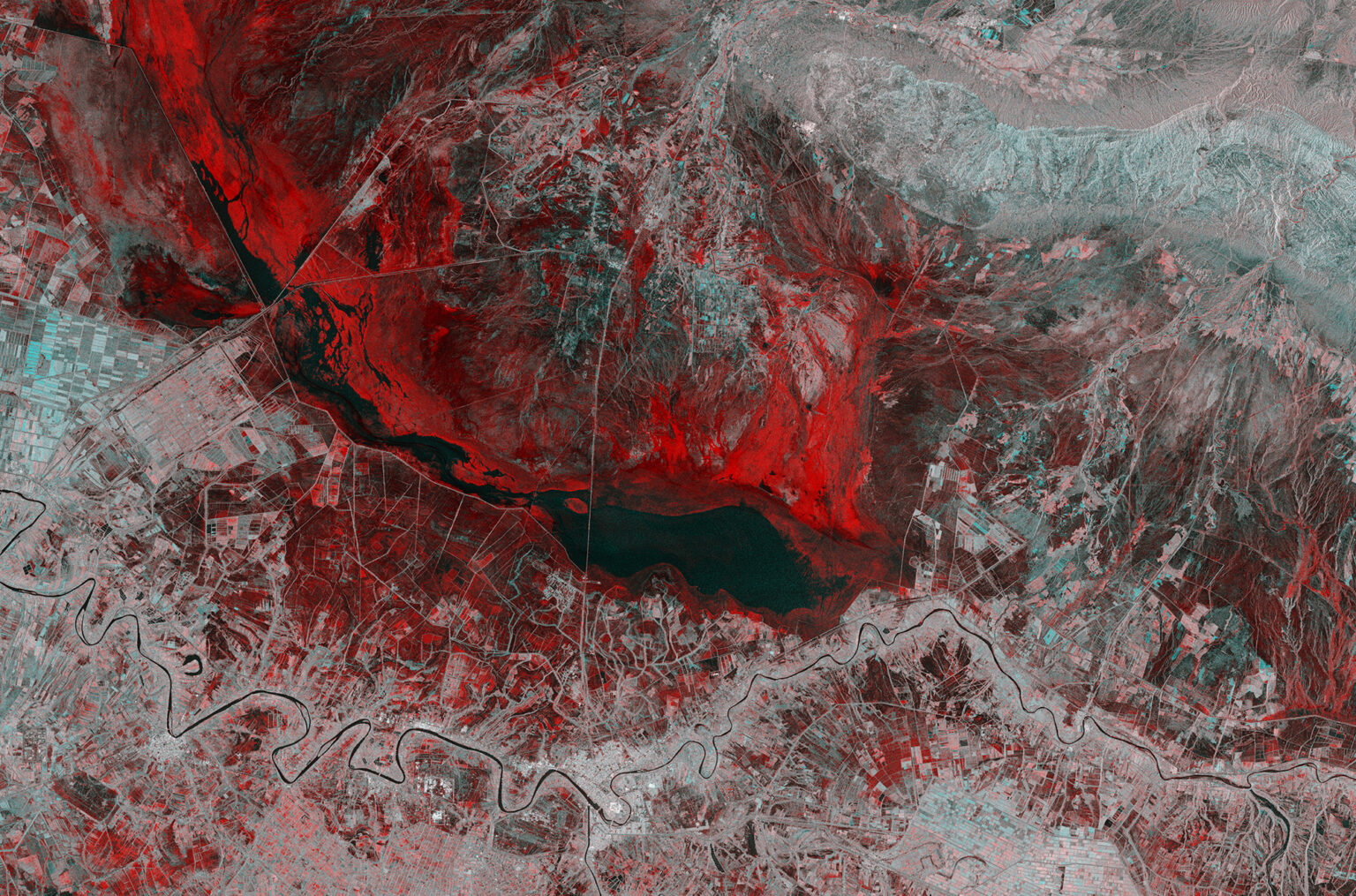
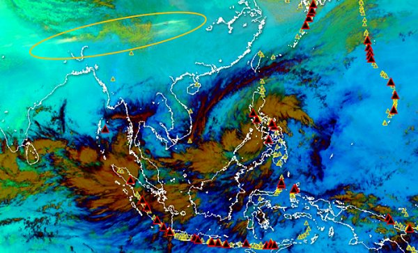
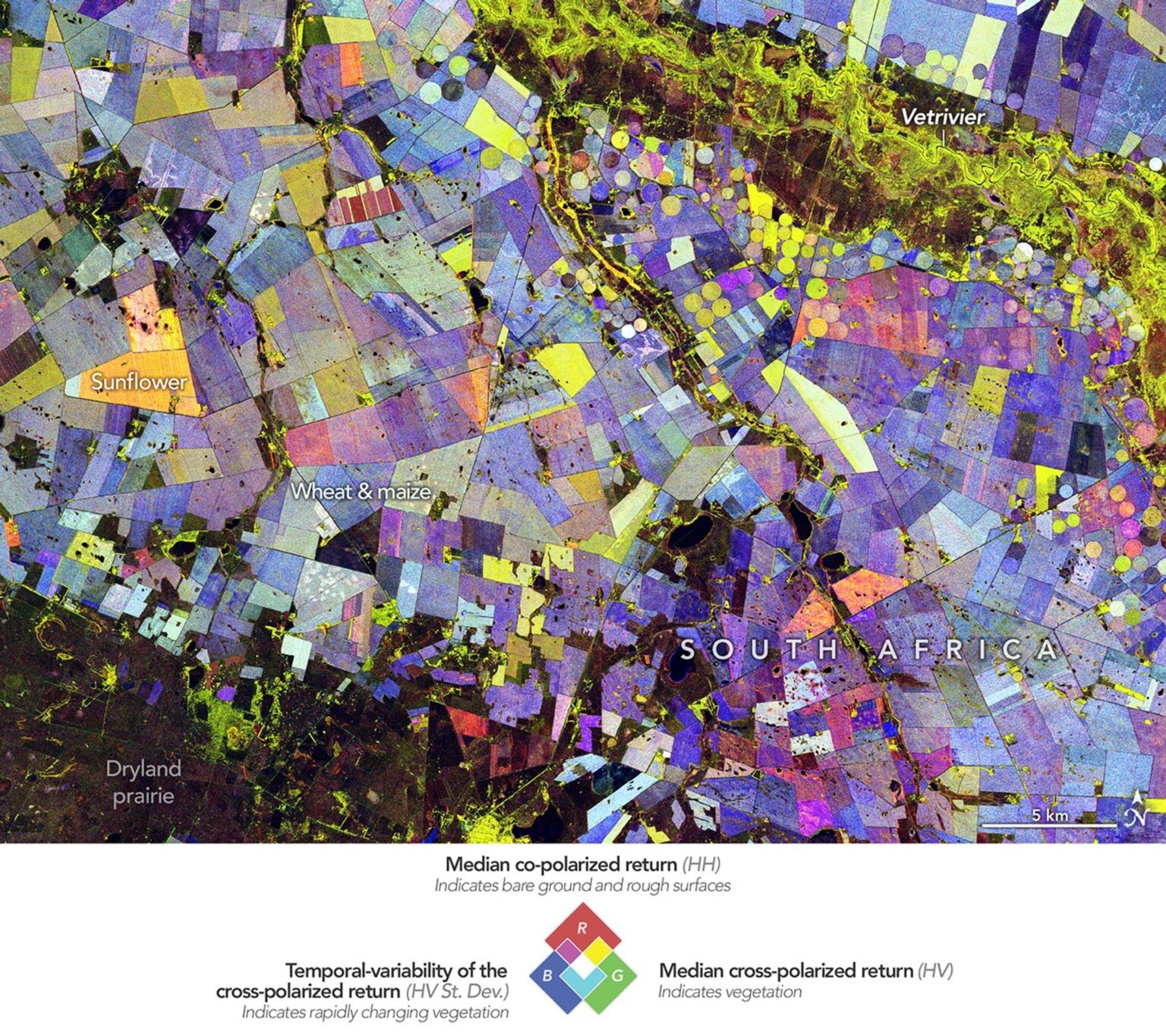
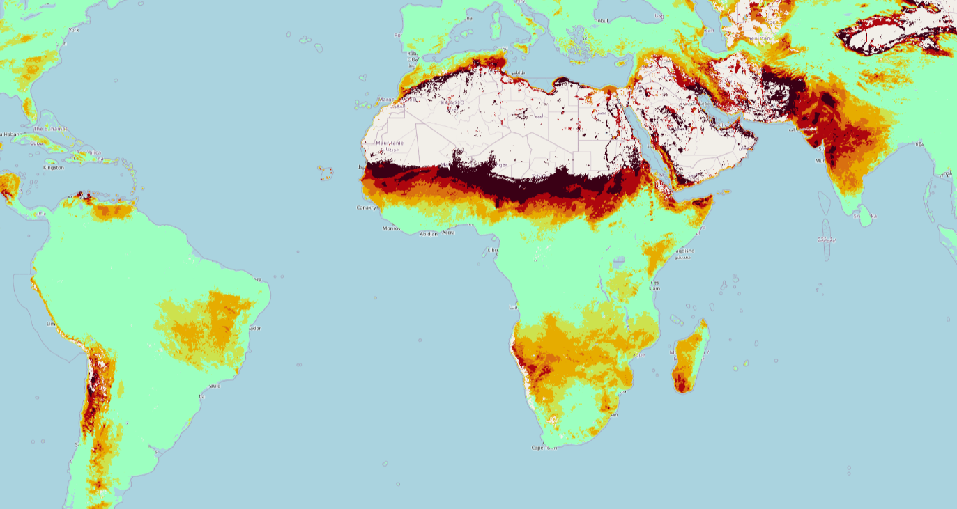
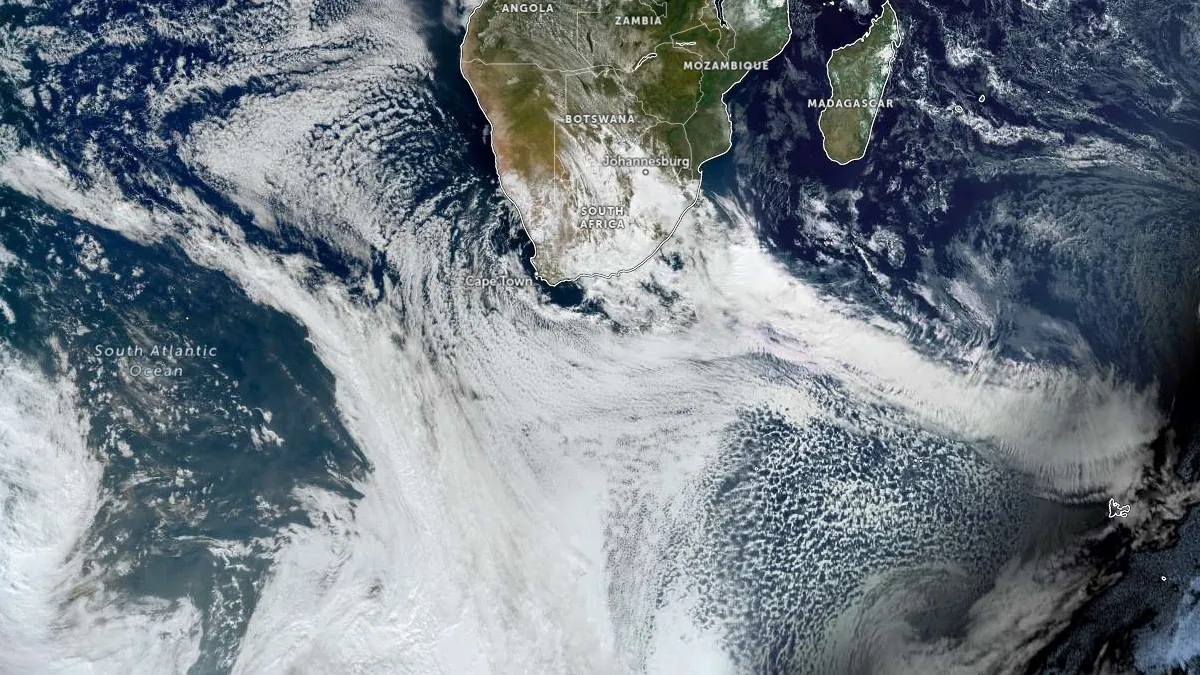
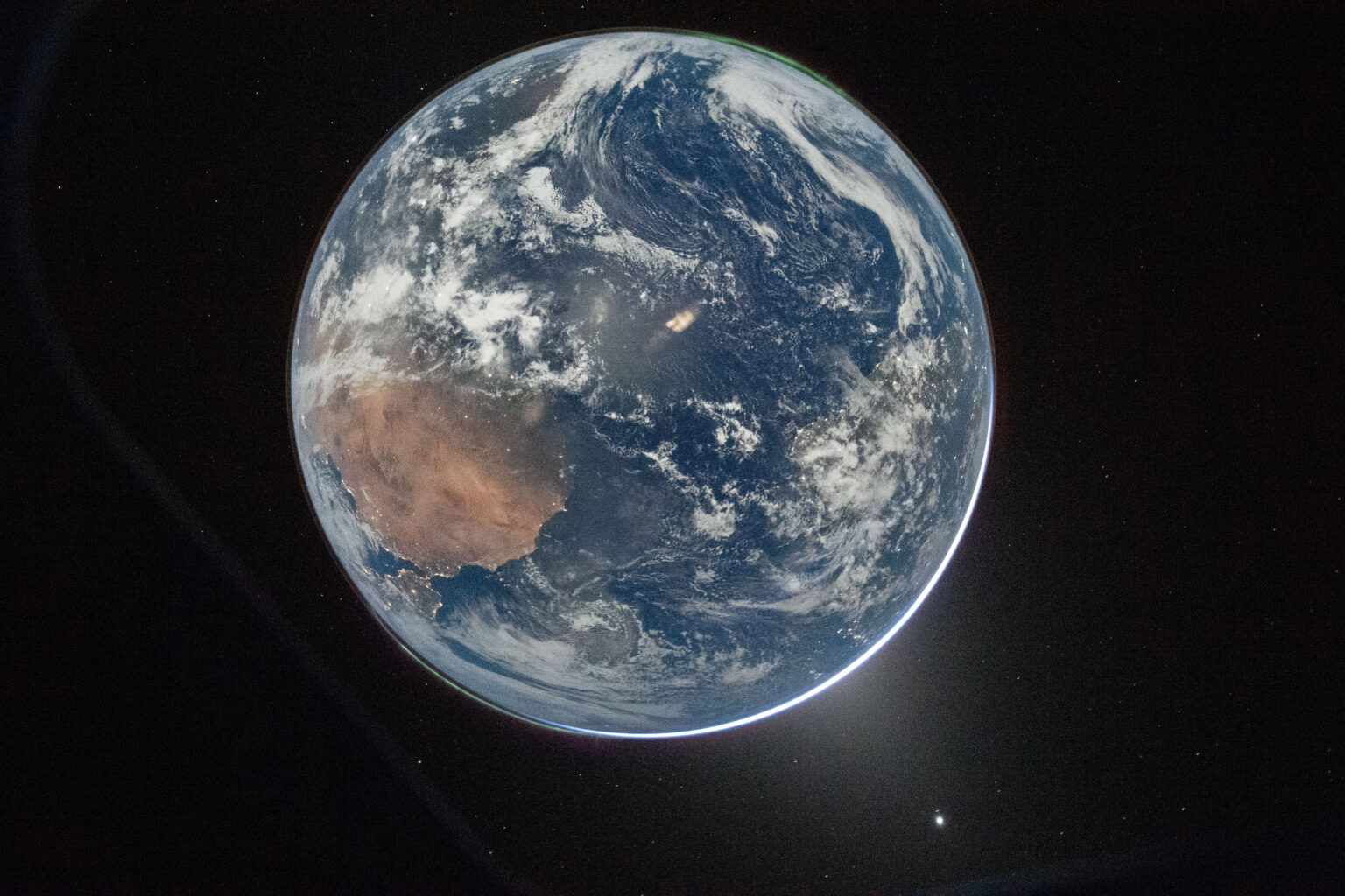
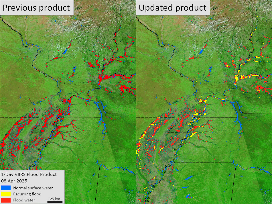
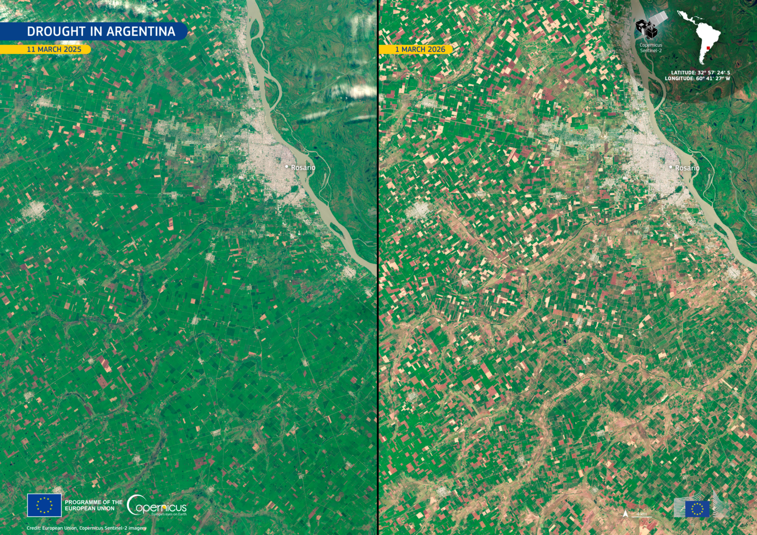
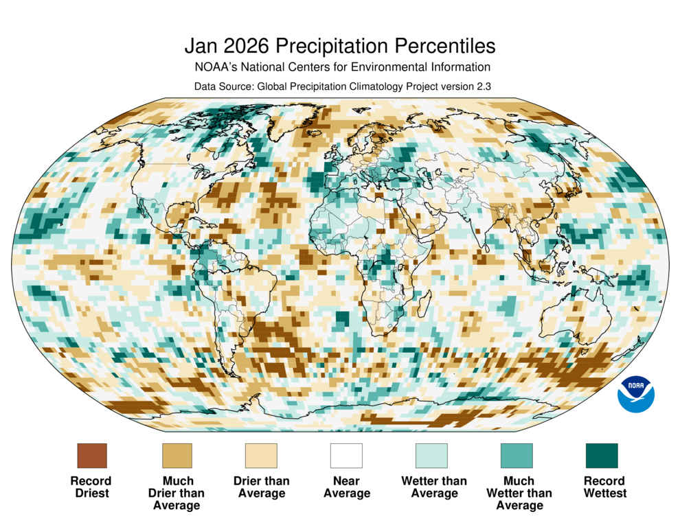
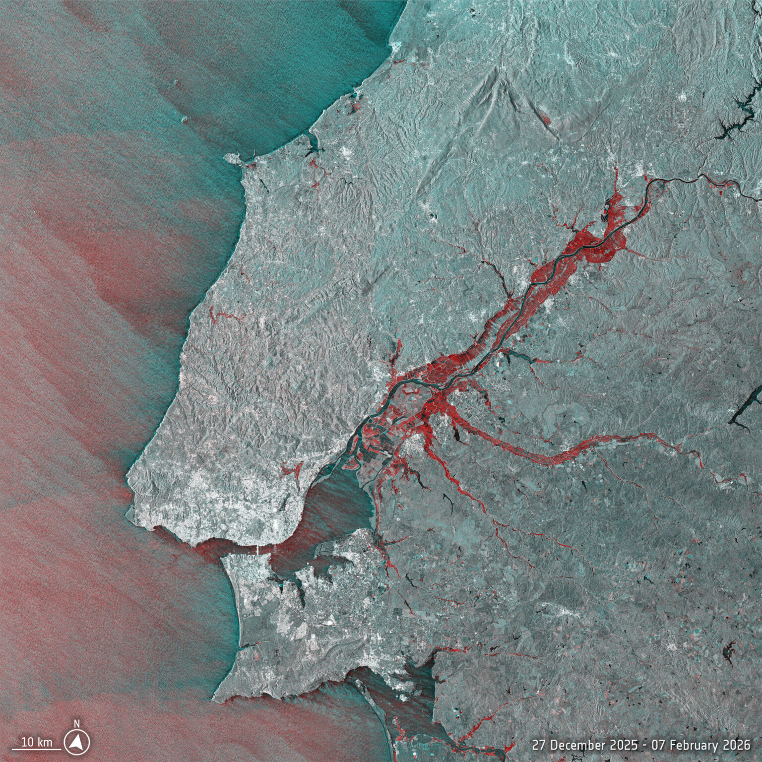
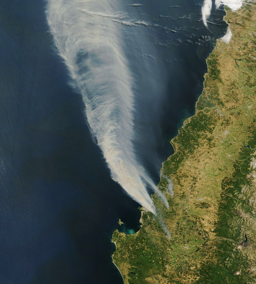
These images have been sourced from across EOTEC DevNet community to showcase examples of how Earth Observations are used to inspire and educate the public, as well as assist scientists and decision-makers in their work. If you have a story to tell with satellite imagery – please submit it via this this FORM.

March 24, 2026

Two satellite views of central Australia show the dramatic transformation of the Alice Springs region after weeks of heavy rainfall in early 2026. The image…

December 22, 2025

In the U.S. Pacific Northwest, a potent atmospheric river spurred waves of heavy rainfall that caused landslides and flooding.

This image shows the total precipitable water vapor in the atmosphere at 11:30 p.m. Pacific Time on December 10. It is derived from NASA’s GEOS (Goddard Earth Observing System)

Vietnam Floods from space
November 10, 2025

In late October 2025, severe flooding struck Vietnam after days of intense rainfall. In this image, flooded areas along the Vu Gia and Thu Bồn appear in blue tones. Open data from the Copernicus Sentinel-1 satellites provides cloud-penetrating radar imagery, which is essential for tracking flood extent and supporting timely emergency response.

Pakistan Flood
September 23, 2025

Extensive flooding in Pakistan has affected millions of people, destroyed infrastructure, inundated a large portion of the country’s agricultural land, and claimed hundreds of lives. The image on the right shows flooding along major rivers in the region on September 9, 2025. For comparison, the left image shows the area on the same day in 2023, when monsoon rainfall amounts were close to normal.

Wildfire burn scars along the Spain–Portugal border
September 11, 2025

Wildfires along the Spain–Portugal border in August 2025, shown in this Copernicus Sentinel-2 image from 5 September, left extensive burn scars around Castromil, O Barco de Valdeorras, and Bragança, providing vital data for post-fire recovery and protection efforts.

August 27, 2025

27 August is the first-ever World Lake Day, dedicated to tracking and protecting the health of millions of lakes around the globe. 

This Copernicus Sentinel-2 image from 13 August 2025 shows Lake Suchitlan, El Salvador’s largest wetland reservoir and a key source of the country’s hydropower.