EOTEC Event
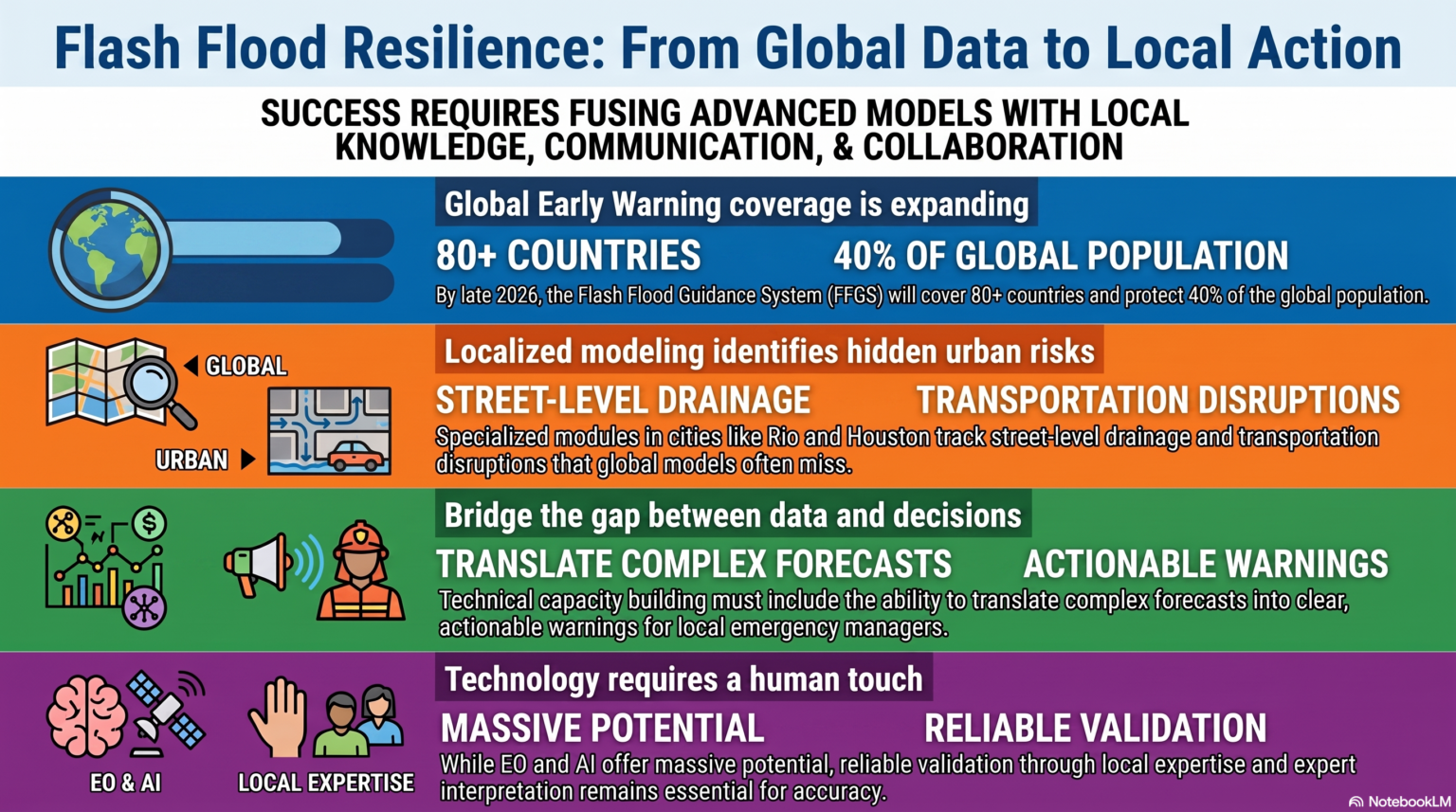
Recap & Resources: Flash Flood Monitoring and Early Warning Systems
EOTEC DevNet’s July 2026 Flood Working Group meet-ups explored how Earth observation, hydrological modelling, operational forecasting systems, and local expertise can strengthen flash flood monitoring,
Uncategorized
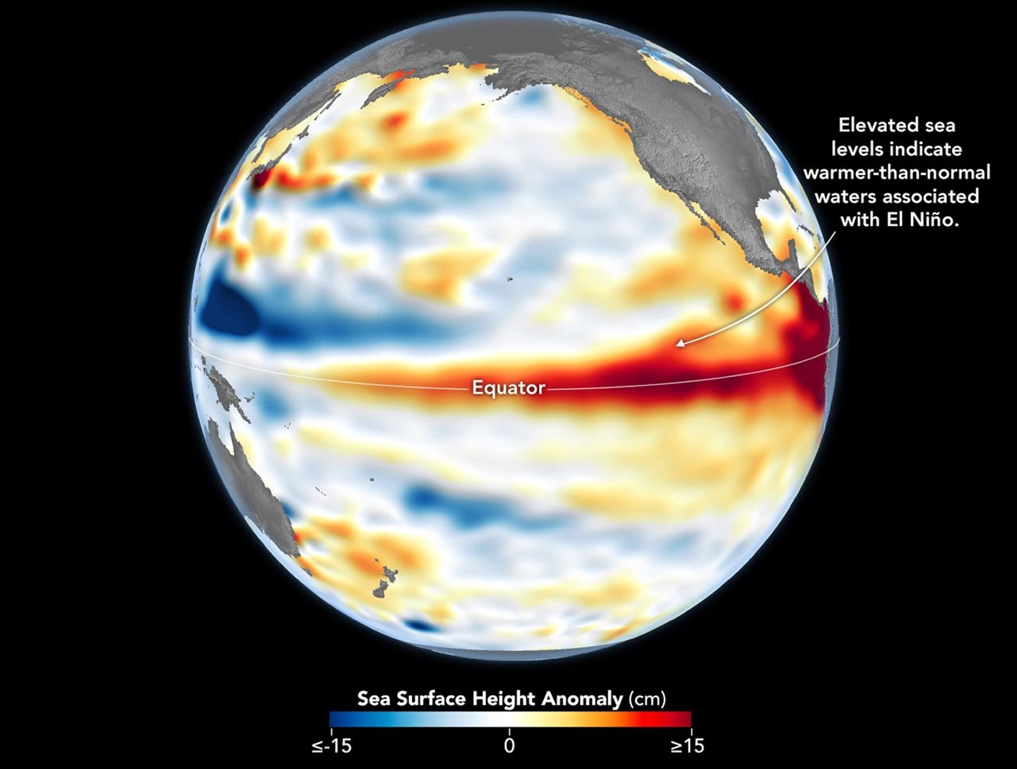
Save the Date: Regional Communities to Explore El Niño Preparedness Sept 16/17
With the ongoing El Niño climate pattern already having an impact on weather around the world, national, regional, and city governments are preparing for potential
Events
Opportunities Round-up: July 24
We’re back with the latest round-up of deadlines, training, and other opportunities to engage with Earth observations and the geospatial community. Share your event: eotecdevnet@gmail.com
Events
Opportunities Round-up: July 2
Our latest round-up features opportunities to advance your EO knowledge, connect to the community, contribute to Venezuela earthquake response, and much more. Share your event:
EOTEC Event
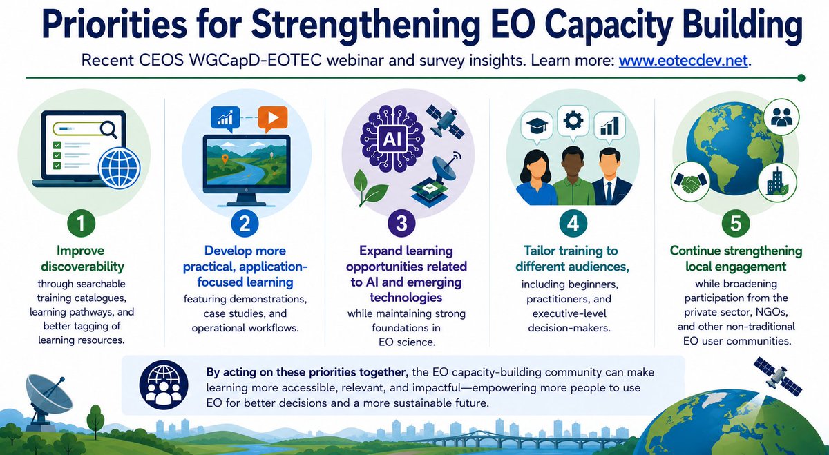
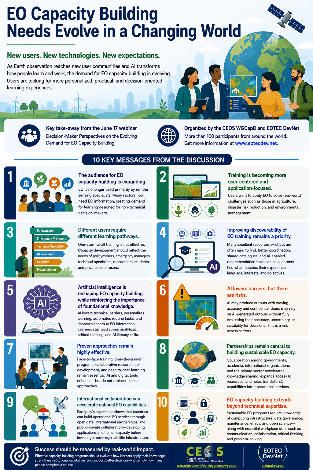
EO Capacity Building Needs Evolve in a Changing World
As Earth observation reaches new user communities and AI transforms how people learn and work, the expectations for EO capacity building are evolving, with users