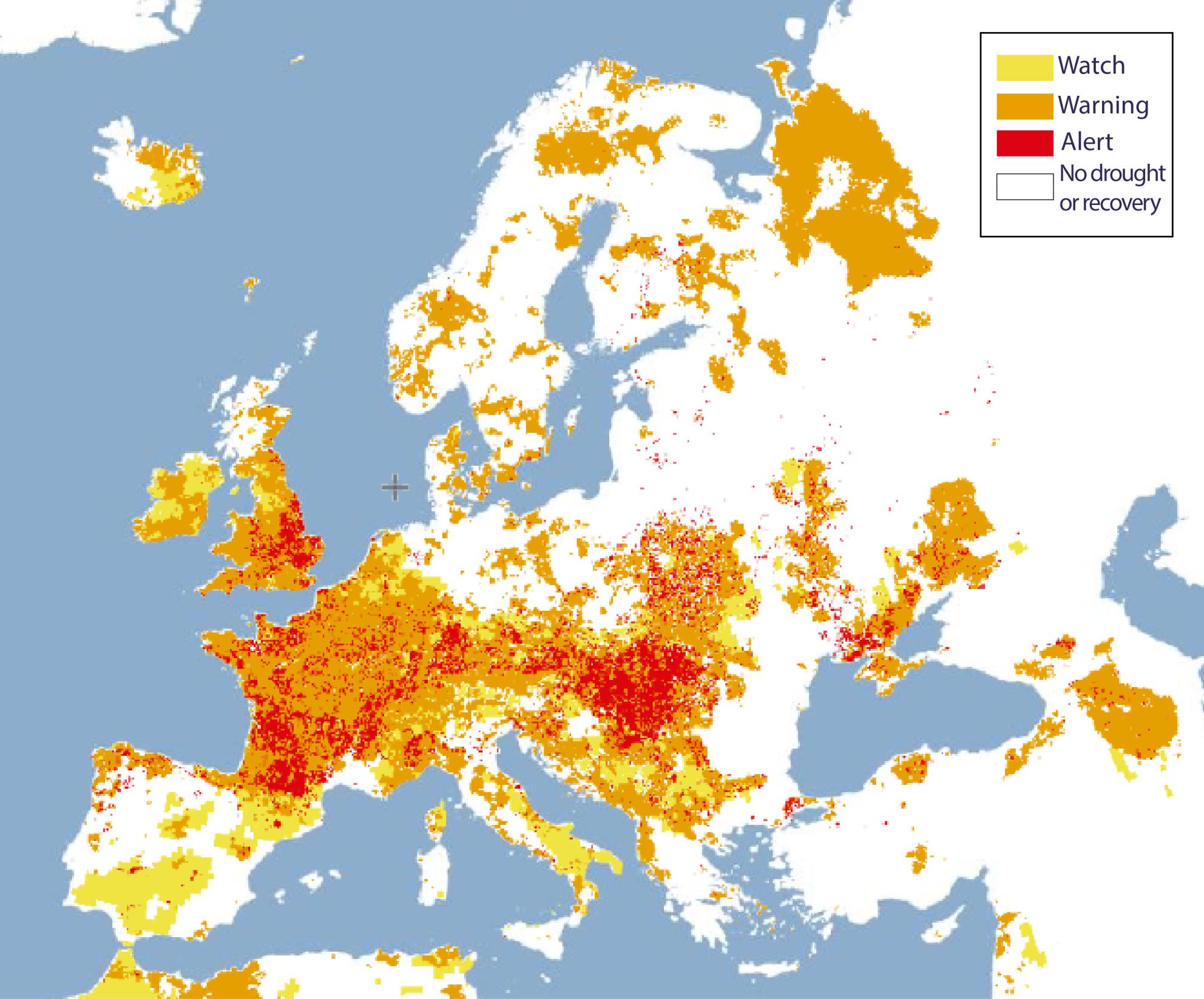
This image captures a satellite-based drought assessment showing widespread and persistent drought conditions across Europe in late July 2026. It was developed using a combined drought indicator, warm spell intensity and river low-flow conditions.
The most severe conditions affected parts of France, southern Germany, the Alps, northern Italy, the Balkans, and central and eastern Europe, while drought intensified in parts of the UK, Ireland, Belgium, and the Netherlands. Some areas of northern Europe and the Iberian Peninsula showed signs of recovery.