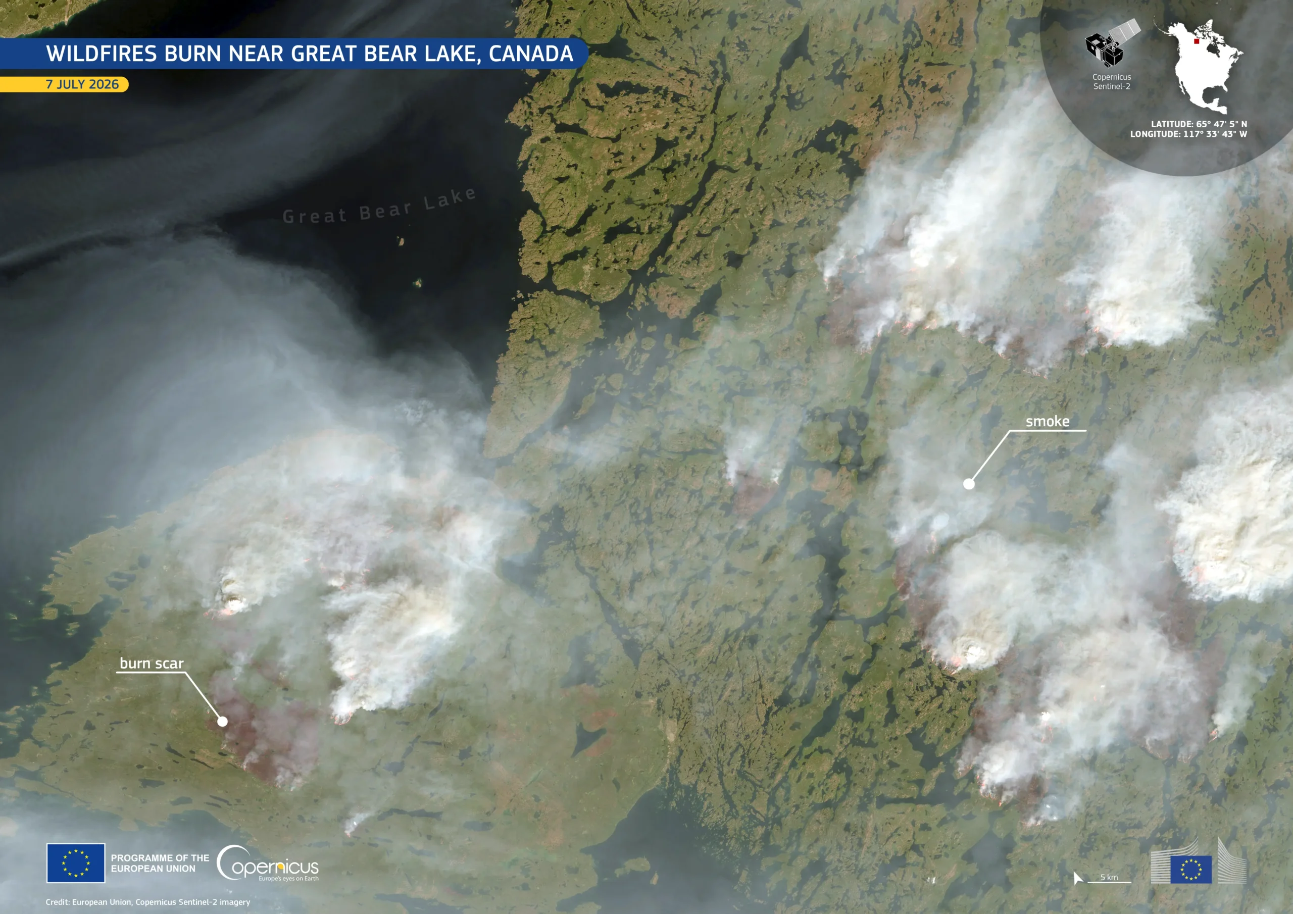
Captured by a Copernicus Sentinel-2 satellite on 7 July 2026, this image shows multiple active wildfires burning near Great Bear Lake in Canada’s Northwest Territories. Thick smoke plumes and extensive burn scars highlight the scale of the fires. Sentinel-2 imagery helps authorities monitor wildfire activity, map burned areas, and support emergency response and recovery efforts in remote regions.
Get more information here.