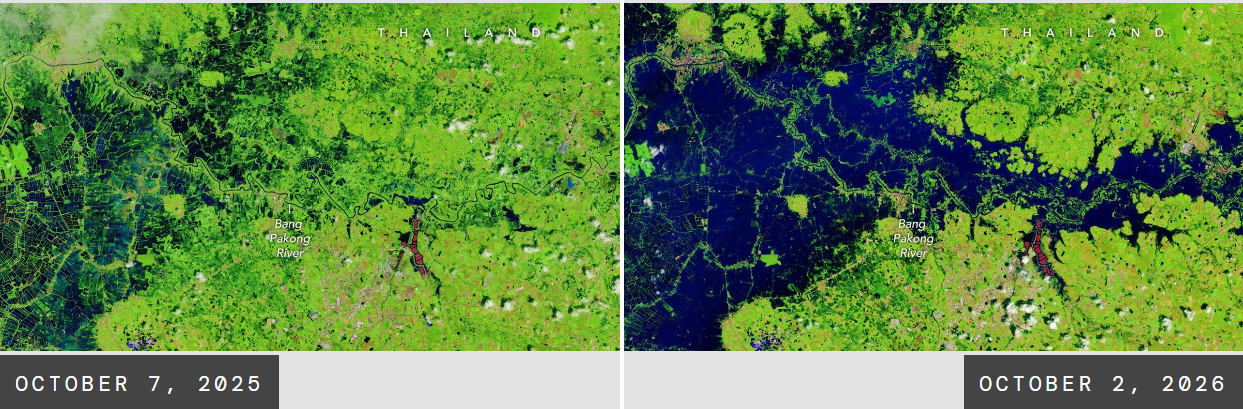
This image shows flooding along the Bang Pakong River in Prachin Buri province, Thailand, on October 2, 2026 (right), compared with the same area at a similar time in 2025 (left).
The false-color images, acquired by NASA-USGS Landsat satellites, highlight floodwater across agricultural areas and aquaculture facilities. Bright red shapes are floating solar arrays.
Persistent heavy rains and intense downpours in late September and early October 2026 caused widespread flooding across Thailand. A stalled low-pressure system helped fuel the heavy rainfall, drawing moisture and energy from the warm Gulf of Thailand. Since mid-September, flooding has affected 50 provinces and more than 4 million people, while an estimated 270,000 hectares (670,000 acres) of farmland were been damaged. Several lives were lost.
Learn more about these images: https://science.nasa.gov/earth/earth-observatory/floodwaters-overwhelm-thailand/