This Photo of the Week highlights the upcoming theme of EOTEC DevNet’s July 8/9 regional meet-ups: flash floods. Often developing within minutes or hours of intense rainfall, flash floods are among the world’s deadliest natural hazards, making timely forecasting, mapping, and early warning essential for protecting lives and infrastructure.
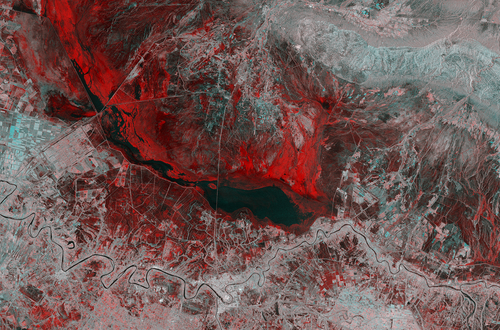
The image combines two radar acquisitions from the Copernicus Sentinel-1 mission over eastern Iraq before and after heavy rains in November 2018. Areas shown in red reveal the extent of flash flooding around the city of Kut, illustrating how radar satellites can detect flooding through clouds, rain, and darkness – providing critical information when conventional optical imagery cannot.
The image is especially fitting this week because it also celebrates the legacy of Sentinel-1A, which officially concluded its mission on 29 June after more than 12 years in orbit. As the first satellite launched for Europe’s Copernicus programme, Sentinel-1A transformed flood mapping and disaster response by delivering freely available radar imagery to users around the world. Its mission may have ended, but its legacy continues through Sentinel-1C and Sentinel-1D and the next generation of radar Earth observation satellites.
EOTEC’s regional flood working group meet-ups will feature short spotlights on operational approaches from around the world – from innovations in early warning systems to regional and local assessment models that are helping protect lives, infrastructure, and communities. Get details on the meetings here.