Image of the Week | Archive

These images have been sourced from across EOTEC DevNet community to showcase examples of how Earth Observations are used to inspire and educate the public, as well as assist scientists and decision-makers in their work. If you have a story to tell with satellite imagery – please submit it via this this FORM.

April 20, 2026

These comparative images illustrate a recent update to NASA’s MODIS and VIIRS near real-time flood products, which now separate recurring flooding (predictable seasonal or annual…

December 22, 2025

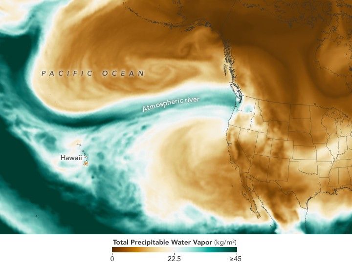
In the U.S. Pacific Northwest, a potent atmospheric river spurred waves of heavy rainfall that caused landslides and flooding.

This image shows the total precipitable water vapor in the atmosphere at 11:30 p.m. Pacific Time on December 10. It is derived from NASA’s GEOS (Goddard Earth Observing System)

Vietnam Floods from space
November 10, 2025

In late October 2025, severe flooding struck Vietnam after days of intense rainfall. In this image, flooded areas along the Vu Gia and Thu Bồn appear in blue tones. Open data from the Copernicus Sentinel-1 satellites provides cloud-penetrating radar imagery, which is essential for tracking flood extent and supporting timely emergency response.