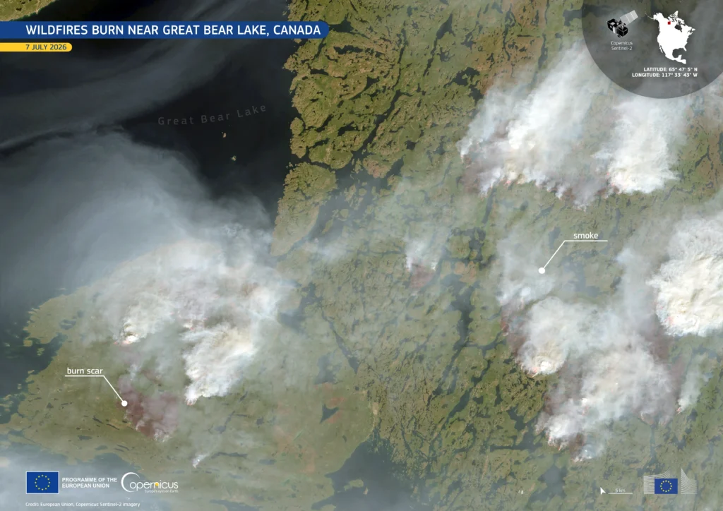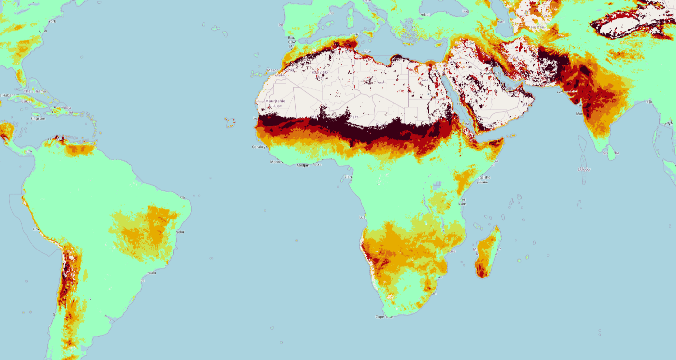
This image shows wildfire risk information generated through GeoVille’s new SatAlert service. This capability, which can be used for wildfire, flood, and drought early warnings, connects Copernicus data with Eutelsat’s OneWeb satellite broadband network, helping deliver critical information quickly even where ground communications are weak, overloaded, or unavailable.
Rather than simply showing a satellite image from space, SatAlert translates complex Earth observation and forecast data into a clearer risk picture that emergency managers can use to monitor conditions and prepare earlier. SatAlert is supported by the European Space Agency through the OneWeb Copernicus Data Hub project.
Along with the disaster early warning service, SatAlert also supports EO Streaming for browser-based access to satellite data and and Archive Builder for creating tailored datasets by region and time period.
Learn more about this image and SatAlert here.