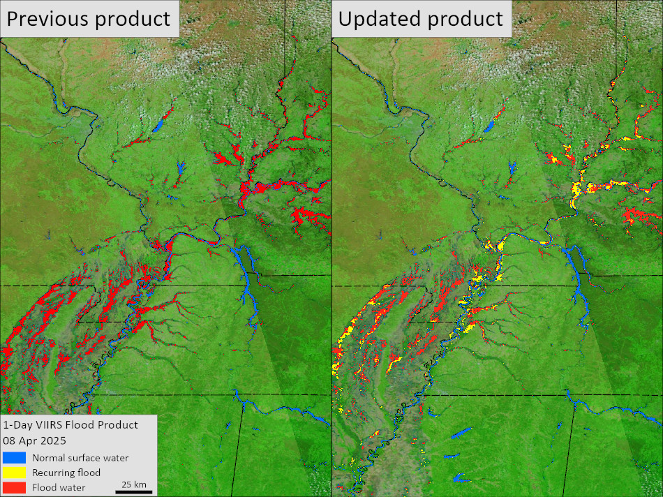
These comparative images illustrate a recent update to NASA’s MODIS and VIIRS near real-time flood products, which now separate recurring flooding (predictable seasonal or annual water expansion) from unusual flood events.
In earlier versions, all water detected outside typical boundaries — such as rivers, lakes, or coastlines — was labeled simply as “flood.” The updated approach highlights routine flooding patterns separately, making it easier to identify unexpected events.
Image 1 (Mississippi/Ohio River regions) and Image 2 (Queensland, Australia) illustrate how this distinction improves clarity and helps users more quickly assess flood extent, prioritize response, and support better-informed decision-making.
Get more detail: https://www.earthdata.nasa.gov/news/blog/nasa-enhances-global-flood-products-smarter-detection-flooding-release-23-year-archive