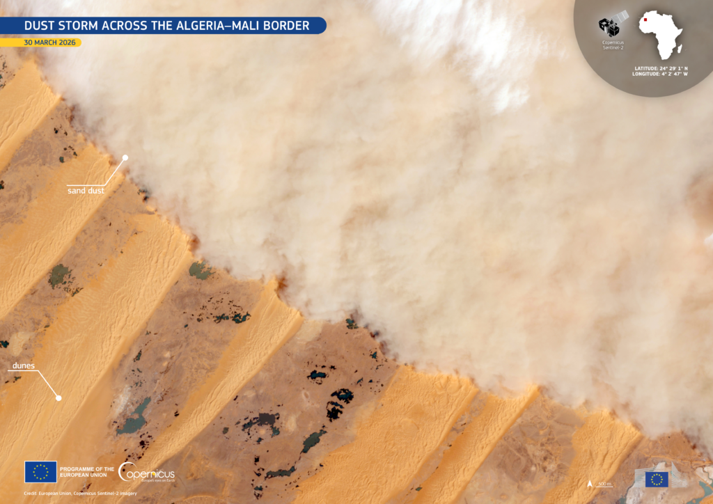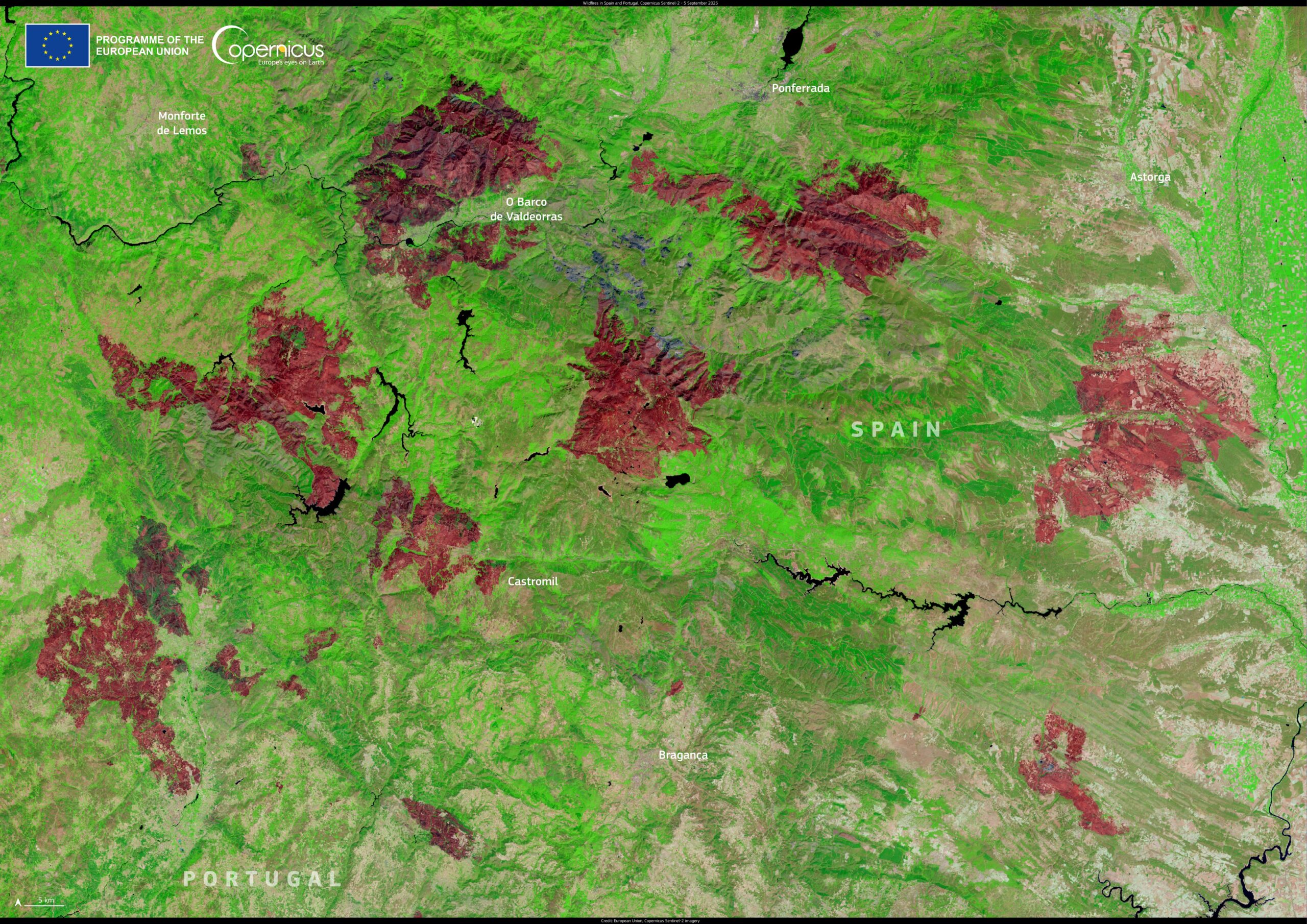
In August 2025, multiple wildfires broke out along the border between Spain and Portugal, affecting natural parks and municipalities, particularly in Galicia and León.
As visible in this false-color image, acquired by one of the Copernicus Sentinel-2 satellites on 5 September 2025, the most affected areas are concentrated around the municipalities of Castromil, O Barco de Valdeorras, and Bragança, where large burn scars in reddish-brown tones reveal the scale of vegetation loss.
The Copernicus Sentinel-2 satellites deliver high-resolution optical data which supports the monitoring of land cover changes, including vegetation loss caused by fires. These insights are key to post-fire assessments, forest recovery planning, and civil protection operations.