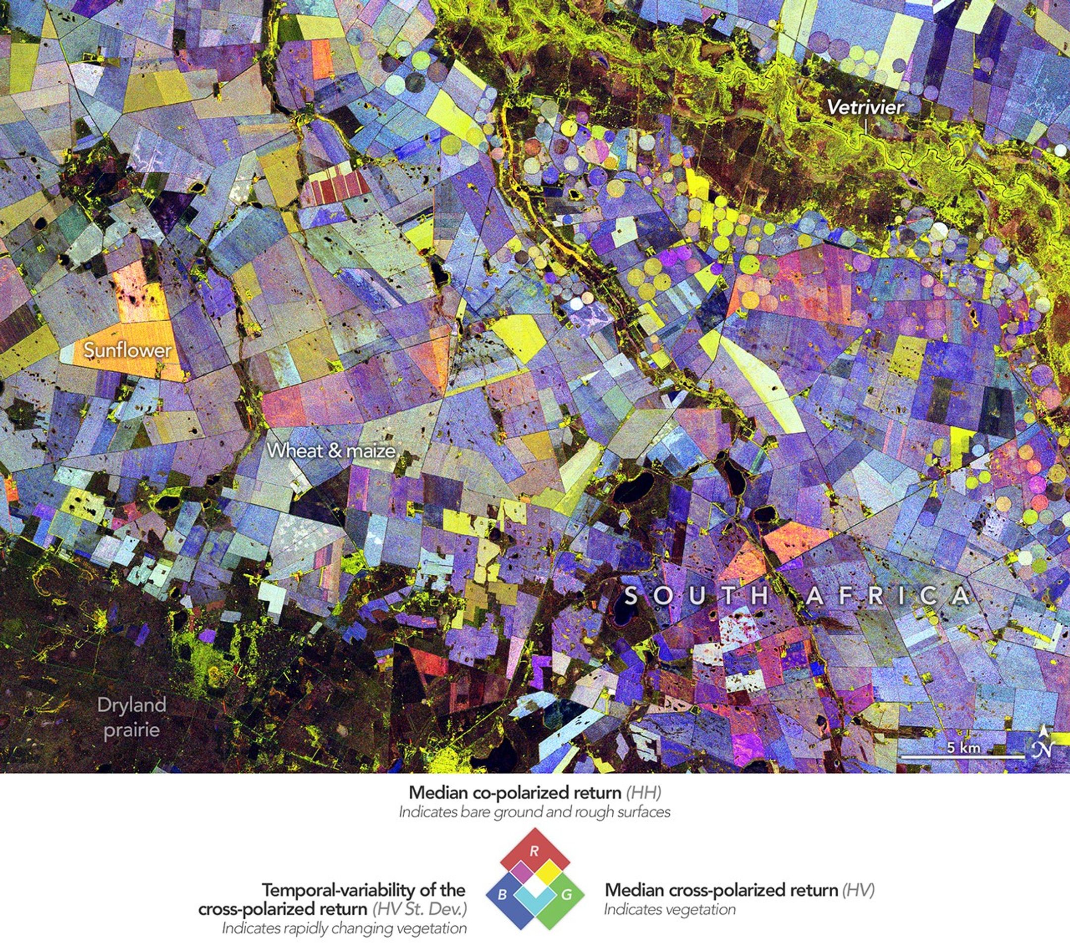
At first glance, this vibrant image of South Africa’s Free State province resembles an abstract painting, with colorful circles and geometric fields scattered across the landscape. In reality, the scene is a powerful demonstration of how the new NISAR satellite can track agricultural activity and seasonal change from space.
Created from radar observations collected by NISAR between November 2025 and March 2026, the false-color composite highlights vegetation in green, unvegetated surfaces in red, and the rate of seasonal vegetation change in blue. The agricultural region, located along the Vet River north of Bloemfontein, is part of South Africa’s productive Maize Triangle, where irrigation supports crops in an otherwise semi-arid environment.
Unlike optical satellites that observe vegetation by its color, NISAR’s L-band radar collects data related to the structure of plants. It can monitor fields through clouds and day or night. By combining data from multiple satellite passes, scientists created a detailed picture of crop growth, harvest cycles, and land-use patterns across the growing season. As NISAR continues to collect data globally, this capability will help researchers and decision-makers better monitor agricultural productivity, water use, and the impacts of climate variability on farming systems.
Get more info: science.nasa.gov/earth/earth-observatory/painting-the-growing-season-in-the-maize-triangle/