Regional Meet-ups Unpack Challenges in Using EO Data for El Niño Preparedness

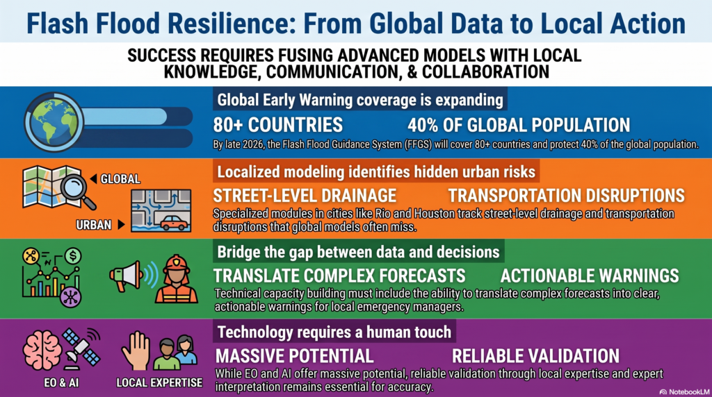
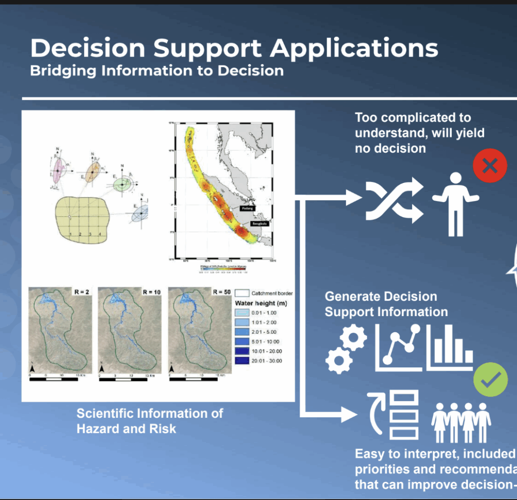
The use of Earth observations (EO) for preparedness and action was featured at EOTEC’s September meet-ups, with participants across all four regions citing a common challenge: while increasingly advanced EO data, forecasts and services are available, they do not always translate effectively into decisions and action.
In this round of Regional Community of Practice Task Team meet-ups, Africa, the Americas, and Asia-Oceania sessions explored El Niño preparedness, while Europe looked more broadly at the use of EO and space-based services for preparedness and civil protection.
Key Takeaways
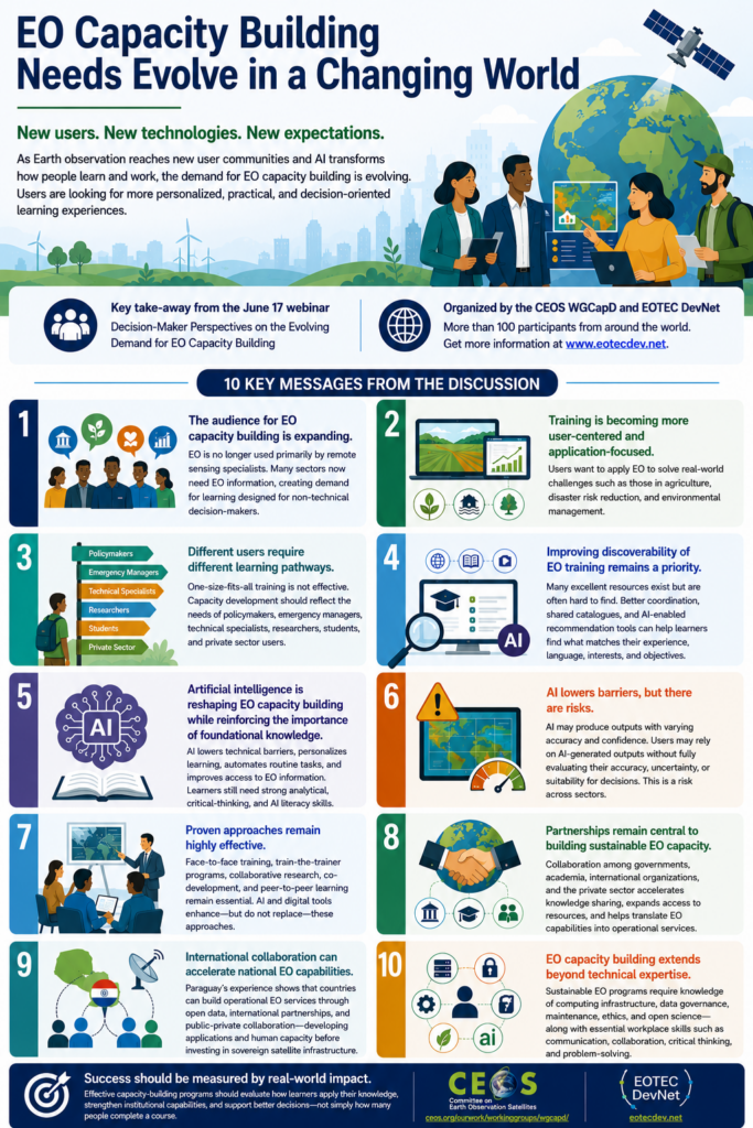
Key participant takeaways from across the regions included:
- From information to action: EO and forecasts need to be translated into expected impacts, decision thresholds and concrete preparedness actions.
- Local relevance matters: Users need more granular, locally relevant and impact-oriented information, adapted to specific sectors and communities.
- Trust and communication are critical: Uncertainty, accuracy and limitations need to be communicated transparently, together with the potential impacts of forecasts and warnings.
- Capacity building goes beyond technical skills: Users also need capacities to interpret information, communicate risk, connect information with procedures and resources, and make timely decisions.
- Coordination and integration remain challenges: Better connections are needed between EO providers, regional organisations, national services, local authorities and operational users, as well as between existing tools and services.
A big thank you to all our spotlight speakers, Regional CoP leads, and everyone who contributed to the discussions!
We will build on these conversations at our Oct 13/14 regional Drought Working Group meet-ups, where we will look at how EO supports anticipatory action and preparedness for drought.
Scroll down to find spotlight recordings, presentation links, short regional summaries and Slido results.
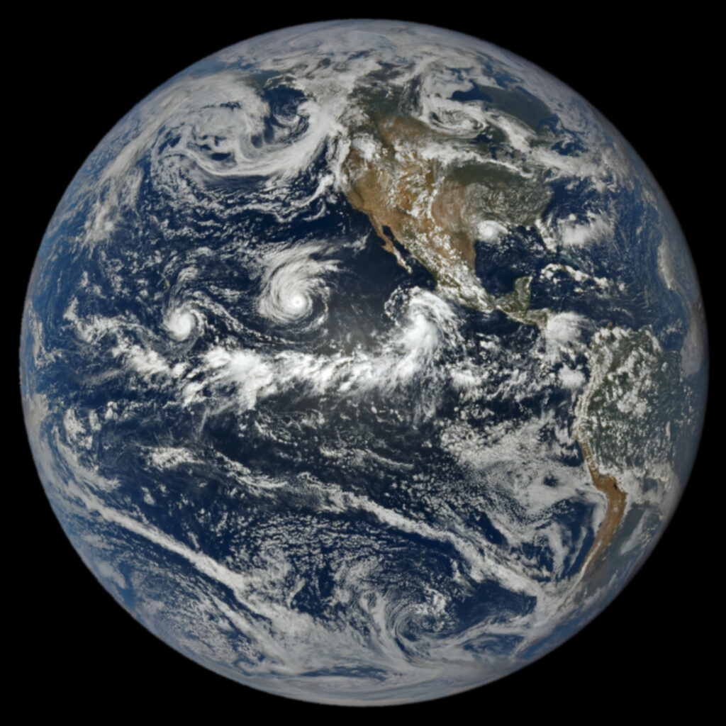
Image: Three tropical cyclones are visible in this satellite image generated by the NASA EPIC camera on the DSCOVR satellite. The El Niño weather pattern tends to foster cyclone activity in the Pacific Ocean. NASA Earth Observatory.
Recordings
Africa
Dr. Meron Teferi Taye’s Presentation | Dr. Hillary Mugiyo’s Presentation
Americas
Dr. Wassila Thiaw’s Presentation| Felipe Costa’s Presentation | Kevin David Rodríguez González’s Demo | Leandro Giorgiano Presentation | Dr. Cédric Van Meerbeeck Presentation
Asia & Oceania
Fatah Masthawee’s Presentation
Europe
Dr. Amélie Grangeat’s Presentation | Dr. Jakub Ryzenko’s Presentation
Meet-up slides
Regional highlights
Africa: Translating forecasts into locally relevant action
Dr. Meron Teferi Taye (IWMI) provided a regional/East African perspective on El Niño preparedness and the use of EO and climate information for anticipatory action, while Dr. Hillary Mugiyo (Ministry of Agriculture, Mechanisation and Water Resources, Zimbabwe) shared practical experience from Zimbabwe, including the use of EO for drought risk monitoring and agricultural preparedness. The discussion highlighted the need for more granular and locally relevant information, clearer translation of forecasts into expected impacts, stronger local capacities, and greater trust in EO information among decision-makers. Connectivity, networking and funding were also identified as barriers.
Americas: Connecting knowledge, governance and action
The Americas session brought together several perspectives on El Niño monitoring and preparedness. Dr. Wassila Thiaw (NOAA) presented the current El Niño situation and outlook; Felipe Costa (CIIFEN/CRC-OSA) discussed regional impacts and preparedness in Latin America; Kevin David Rodríguez González demonstrated a geospatial platform for monitoring El Niño, La Niña and climate anomalies; and Leandro Giorgiano and Tomás Calvi (National Water Institute, Argentina) presented hydrological early-warning approaches for the La Plata Basin. A presentation on El Nino impacts in the Caribbean was also submitted by Dr. Cédric Van Meerbeeck (The Caribbean Regional Climate Center, CIMH). The discussion focused on impact-based forecasting, community-based early warning, trust in climate information, and the need to connect scientific information with local knowledge, decision thresholds, protocols and resources.
Asia & Oceania: Trust, impact and timing
Fatah Masthawee (Thai Meteorological Department) shared Thailand’s approach to monitoring and preparing information related to El Niño. The discussion highlighted impacts on agriculture and water resources, as well as challenges around trust, misinformation and validation. Participants stressed the importance of communicating EO and early warning information together with its potential impacts and ensuring that information reaches decision-makers early enough to support action.
Europe: Integrating EO into operational preparedness
Dr. Amélie Grangeat (Edelweiss Resilience / SUNSHINE) presented the SUNSHINE approach to building civil-protection capacity to use European space-based services, while Dr. Jakub Ryzenko (Crisis Information Centre, CBK PAN) introduced the Space Resilience Nodes approach and its role in connecting space-based solutions with civil-protection communities. Discussion highlighted fragmented services, challenges integrating them into organisational processes, gaps in standards and harmonisation, and the need to move beyond project demonstrators towards sustainable operational implementation. Preparedness scenarios, practical demonstrations and stronger relationships between technical experts and operational users were identified as important approaches.
Summary of Slido / discussion findings
Participants across the regional meetings were asked two common questions:
- What are the main gaps or challenges in coordination, capacities, or access to information?
Responses and discussions highlighted:
- insufficiently localised and granular information;
- limited trust or acceptance of EO information among some decision-makers;
- poor internet connectivity and networking;
- funding limitations;
- language barriers;
- fragmentation of services and information across different platforms;
- difficulty integrating available services into organisational processes;
- lack of harmonised standards, procedures and terminology; and
- challenges ensuring long-term sustainability and avoiding dependence on individual providers or projects.
- What could help strengthen preparedness, and where could regional collaboration or capacity development add value?
Participants highlighted:
- stronger networking and communication;
- more local and impact-oriented forecasts and information;
- community-based early warning approaches;
- stronger relationships between local stakeholders and technical experts before disasters occur;
- practical demonstrations and success stories;
- preparedness scenarios and exercises that also account for changing climate conditions;
- stronger governance and institutional capacities;
- improved capacity to transform information into operational action; and
- greater regional collaboration to identify shared gaps, exchange approaches and connect existing capacities.