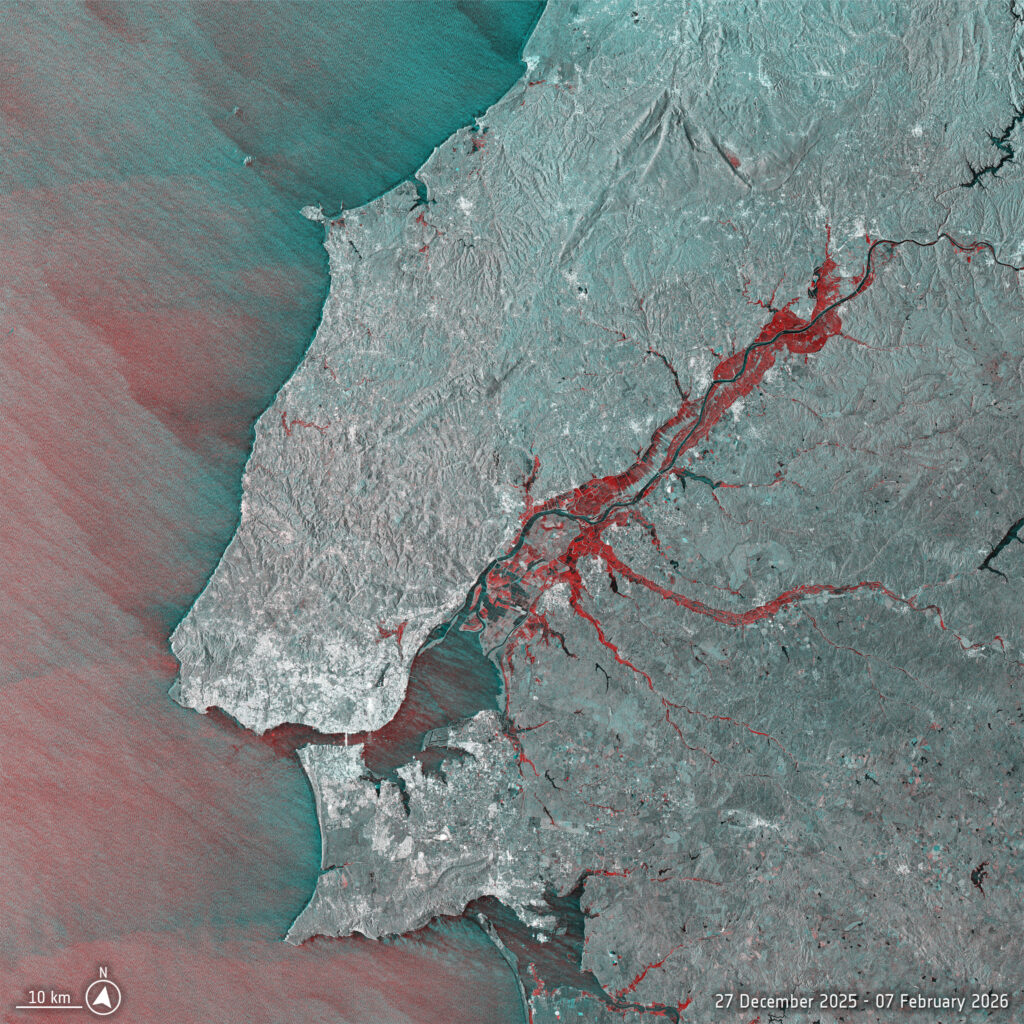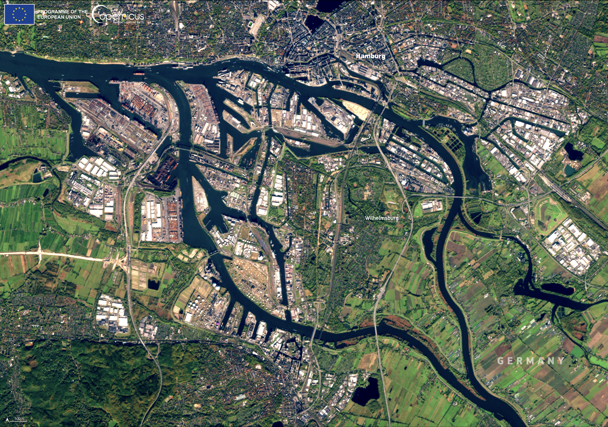
Hamburg, Germany’s second-largest city and a key economic center, has developed a robust flood management system to address rising risks from increased rainfall and storm surges. A central part of this system is Wilhelmsburg, an island district within the city that combines industrial zones with green spaces and plays a critical role in flood protection efforts. As seen in a Copernicus Sentinel-2 image, the Port of Hamburg and surrounding areas along the Elbe River are integral to both economic activity and environmental resilience. Copernicus open data aids these efforts by providing essential information for urban planning, land use, and climate adaptation in flood-prone coastal cities like Hamburg.