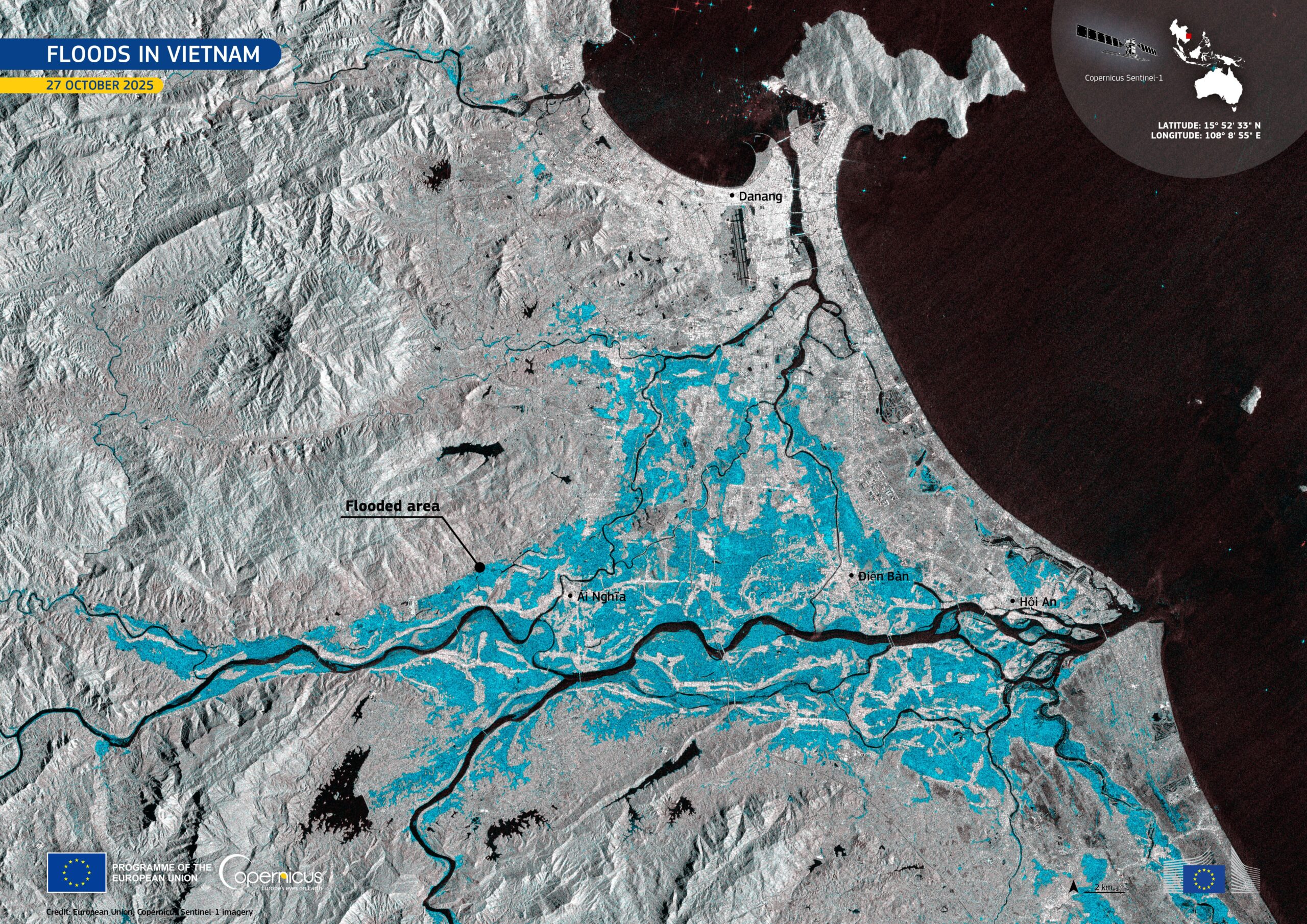
In late October 2025, severe flooding struck Vietnam after days of intense rainfall. Thousands of residents evacuated their homes, with local authorities reporting at least 37 casualties. The province of Quảng Nam has been particularly affected by the impacts of the flooding.
In this image, acquired by one of the Copernicus Sentinel-1 satellites on 27 October 2025, flooded areas along the Vu Gia and Thu Bồn rivers near Ái Nghĩa, Điện Bàn, and Hội An appear in blue tones.
Open data from the Copernicus Sentinel-1 satellites provides cloud-penetrating radar imagery, which is essential for tracking flood extent and supporting timely emergency response, even during adverse weather conditions.
Source: www.copernicus.eu/en/media/image-day-gallery/devastating-flooding-vietnam