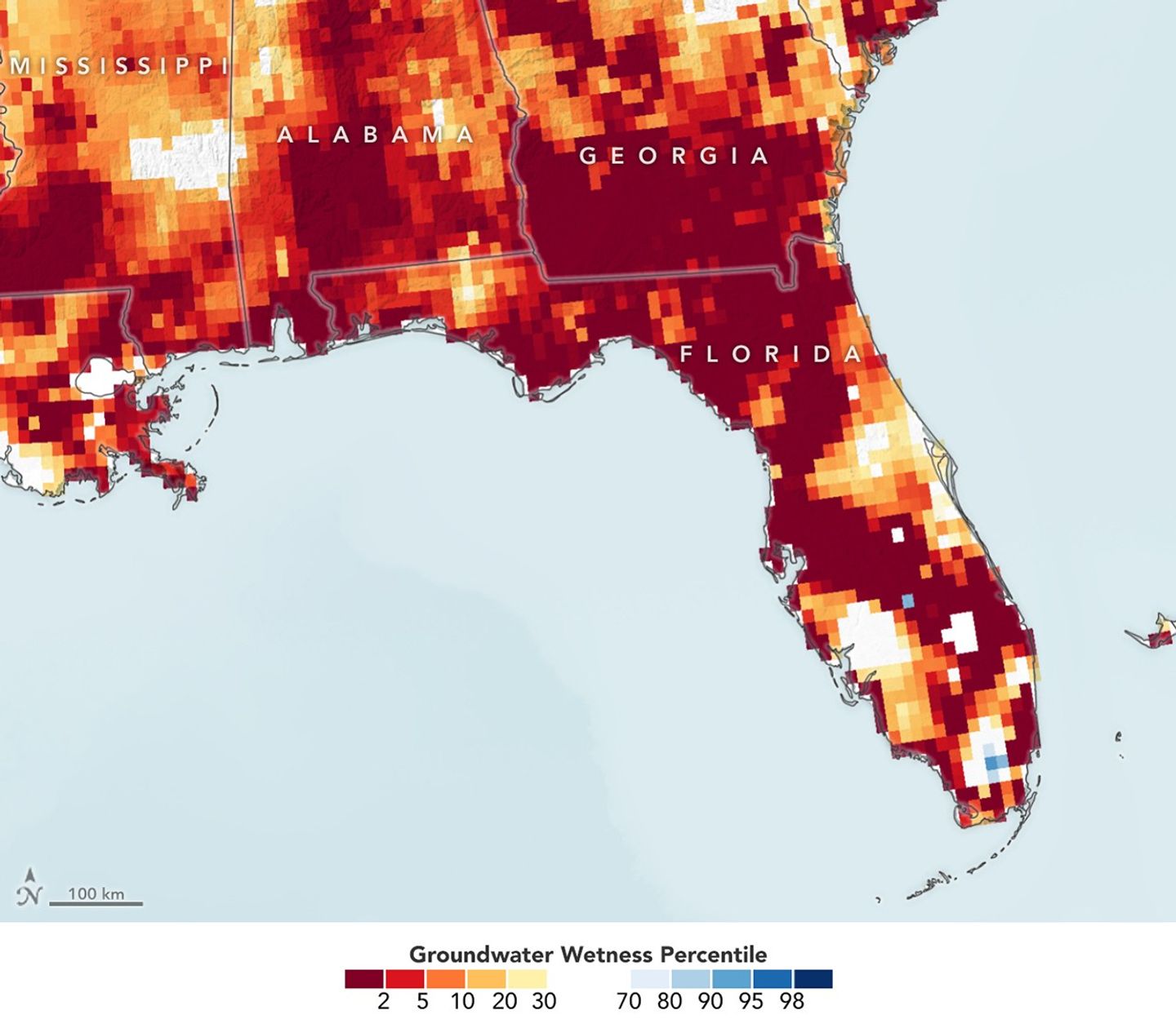
This map, based on imagery from NASA’s GRACE FO satellites, illustrates the extent of ongoing drought across much of Florida and parts of neighboring states.
The deep reds and oranges in the map mark areas of unusually low groundwater while cooler blues indicate wetter-than-normal regions, highlighting both the severity and uneven distribution of the drought.
Nearly all of Florida faced at least “moderate” drought, and nearly 80 percent faced “extreme” conditions in April 2026, according to data from the U.S. Drought Monitor. Typically, Florida is among the wettest U.S. states.
The prolonged dry conditions — among the most extensive in over a decade — have contributed to water restrictions, agricultural stress, heightened wildfire risk, and impacts on sensitive ecosystems such as the Everglades.
Get more detail at the NASA Earth Observatory: science.nasa.gov/earth/earth-observatory/drought-parches-florida/