In January 2026, flooding events took place across the globe, including central and western Albania, southeastern Australia, Italy, the U.S. Pacific Northwest, Southern Africa and Tunisia.
In Southern Africa, dozens across the region lost their lives. In Mozambique’s Gaza and Maputo provinces, some 300,000 people were displaced.
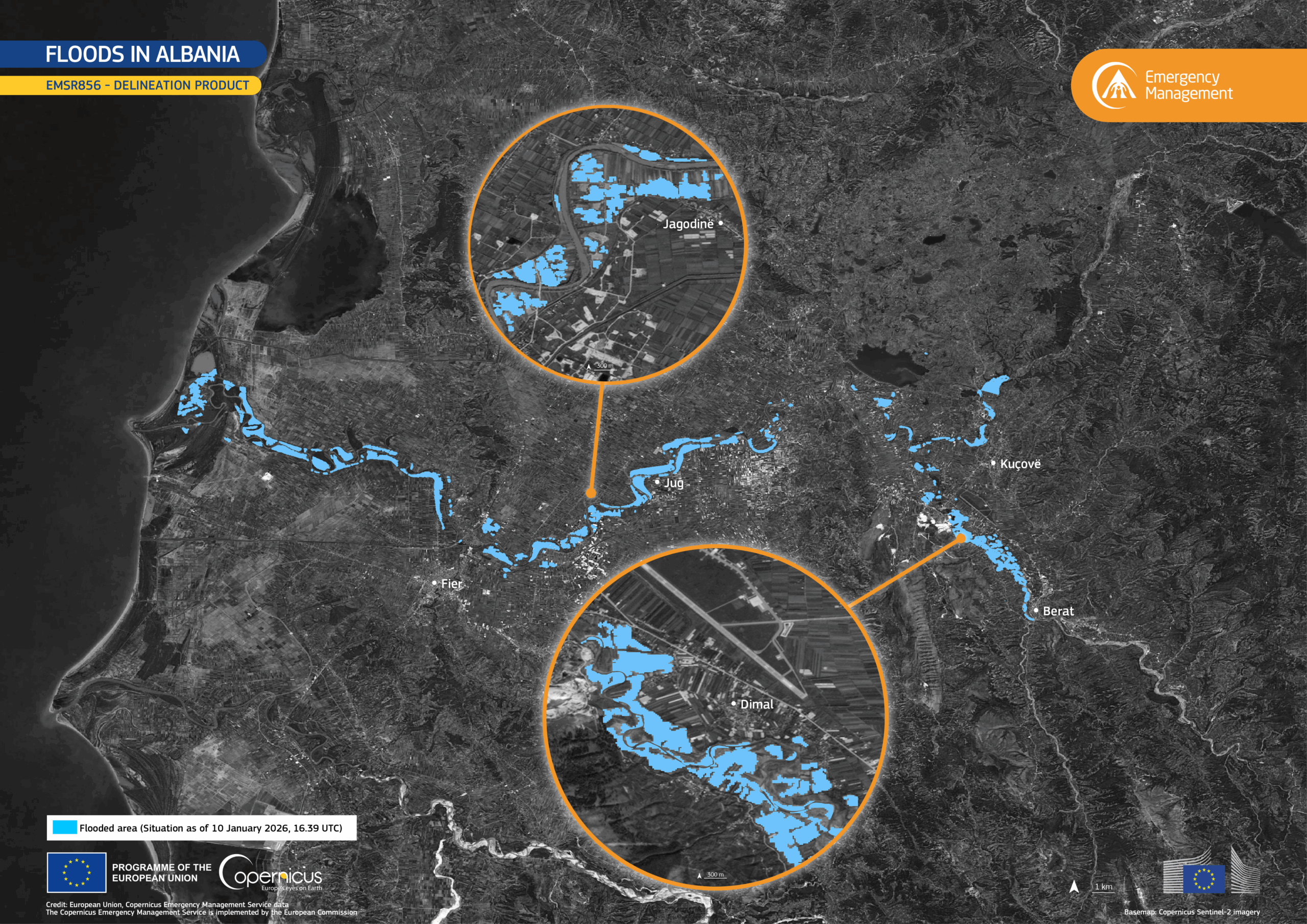
On January 9, the Copernicus Emergency Management Service (CEMS) was activated to assess the extent of the flooding in Albania. This data visualization, produced using the CEMS delineation product, shows the flooded areas as of 10 January 2026, with the inundated zones represented in the color cyan.
The information provided by CEMS supports civil authorities in monitoring, mapping and responding to disasters.
More information about this activation and others is available here: https://mapping.emergency.copernicus.eu/