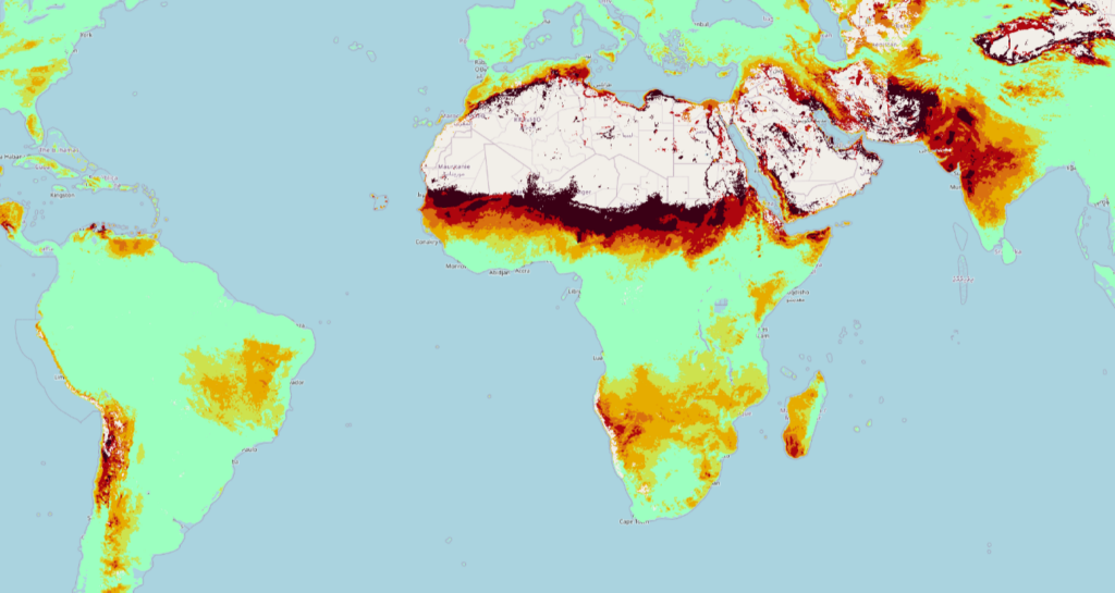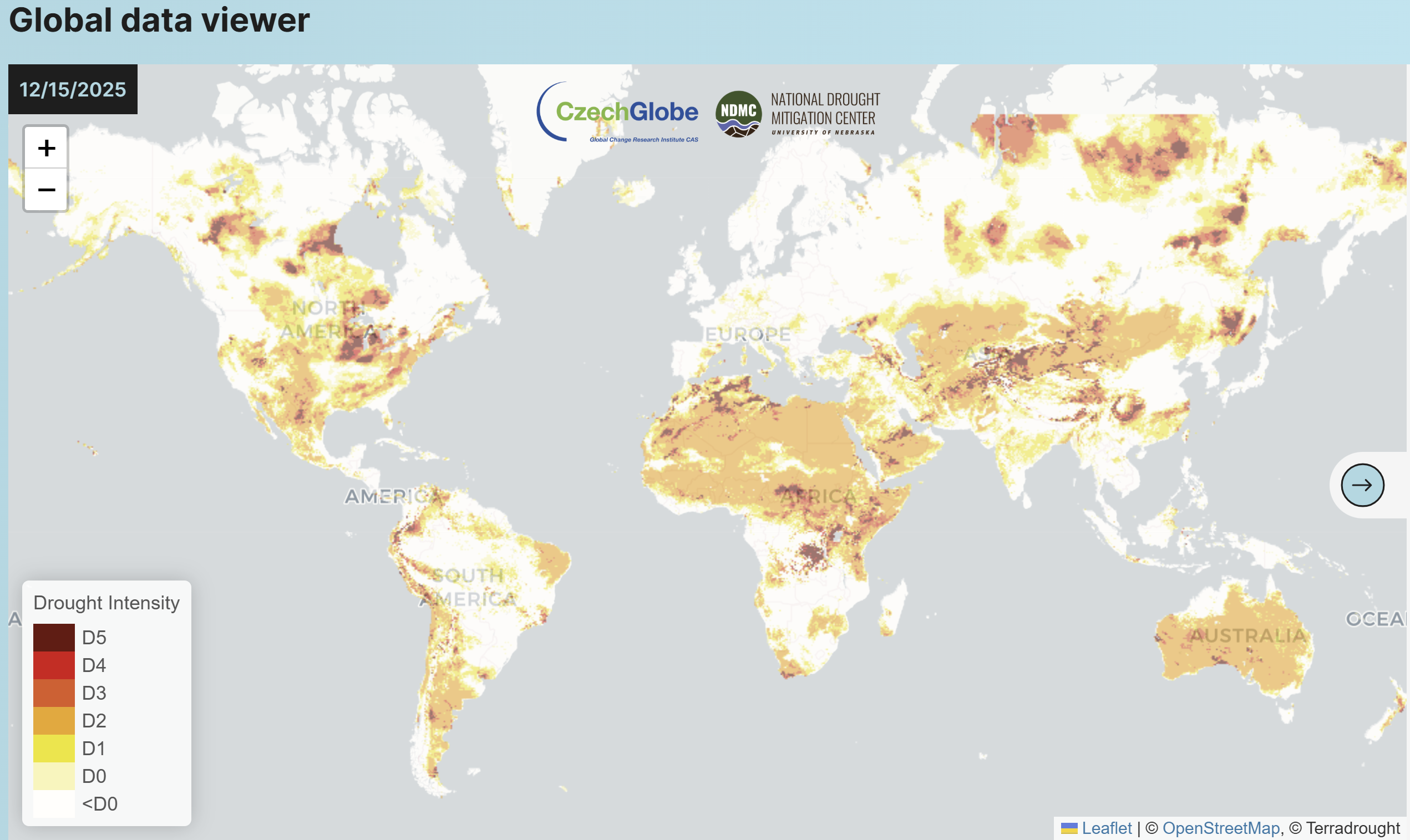
This December 15, 2025 image of global drought intensity was produced by TerraDrought, a new tool that delivers near-real-time insights into drought conditions across the globe.
By combining forecasts, observations, and impact reports, the tool helps users anticipate risks and respond effectively. Its data layers include: drought intensity, drought impacts, soil moisture deficit, relative soil saturation, SPI, SPEI, PDSI and Z-score.
TerraDrought was created through collaboration of the National Drought Mitigation Center at the University of Nebraska in the U.S. and CzechGlobe, the Global Change Institute at Czech Academy of Sciences.
Explore the tool: https://terradrought.eu/index.html
Share your feedback with our online drought community: https://eotecdev.net/networks/droughts/