Meet our leadership: Terefe Hanchiso Sodango, Africa Region Community of Practice

Along with Effiom Oku of the Nigerian Meteorological Agency, Dr. Sodango co-leads the Africa CoP Task Team. He shares his take-aways from working with partners to apply Earth information to decision-making.
Dr. Terefe Hanchiso Sodango is an assistant professor at Wolkite University (Ethiopia), where he teaches undergraduate and graduate courses on applied GIS, remote sensing, computer programming, surveying and mapping, land use planning, and related fields. He has published in peer-reviewed journals and presented at national and international workshops and conferences. A reviewer for various journals, he has also been involved in various international collaborations including: the ERASMUS+ project on “Innovation on Remote Sensing Education and Learning”; International University Cooperation on Land Protection in European-Asiatic Countries; the and Rift-Valley Lakes Basin Development Project (2021-2035).
Q – Alongside your work as professor, you provide support to government and non-governmental organizations. What have you learned about working with partners to apply Earth information to decision-making?
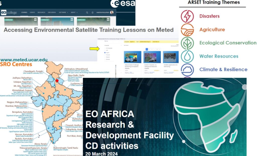
I have found promising progress and demand for the use of Earth observation data, services, and tools to address complex challenges. However, there is still a critical shortage of hard and soft skills, knowledge and commitment in applying these resources for sustainable development in various sectors.
Q – How did you get into remote sensing and Earth observation?
Since an early age, I had an aspiration to contribute my part for the mitigation of environmental challenges, including land degradation, land use change, vegetation and water resources, climate, and biodiversity issues. I had a chance to study remote sensing and Earth observation at prestigious universities such as Fujian Normal University in China and the University of Twente, ITC, in the Netherlands. I am applying the skills and knowledge I obtained to solve these environmental challenges.
Q – What are your main research areas?
Optical & SAR sensing applied to environmental, ecological, and urban monitoring, water and vegetation monitoring, deep/machine learning, geospatial analysis, and visualization.
Q – If you had the power to change one thing about our world, what would it be?
I would like to provide the least-developed regions – such as Africa – with access to high-quality remote sensing data, products, and tools. This would enable users with low incomes to make better decisions about natural resources, disasters, and climate, and help build a more resilient, fair, and sustainable future.