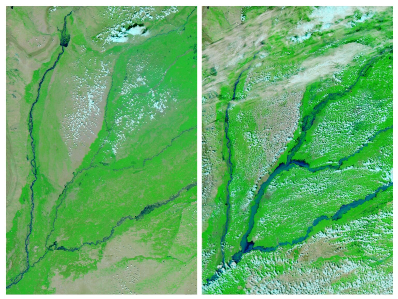
Image of the Week | Archive

These images have been sourced from across EOTEC DevNet community to showcase examples of how Earth Observations are used to inspire and educate the public, as well as assist scientists and decision-makers in their work. If you have a story to tell with satellite imagery – please submit it via this this FORM.

July 7, 2025

On 1 July 2025, the “Torrefeta i Florejacs” fire broke out in the Segarra region of Catalonia, Spain.  It burned approximately 5,000 hectares across several municipalities.…

June 16, 2025

These Copernicus Sentinel-2 images illustrate the decline in water levels at the Asprokremmos Reservoir, an important freshwater source for agriculture and local communities near Nikokleia in southwestern Cyprus. Acquired on 6 June 2024 and 3 June 2025, the images show a significant reduction in surface water extent, with the surrounding fields appearing noticeably more arid.

March 17, 2025

The Great Aletsch Glacier in Switzerland, like many in the Alps, has been rapidly retreating and thinning over the past four decades. Satellite images reveal significant ice loss, with Swiss glaciers losing 2.5% of their volume in 2024 alone.

March 10, 2025

A powerful February storm brought heavy rain and severe flash floods to the U.S. states of Tennessee and Kentucky, causing evacuations and widespread damage. Forecasters warned of more cold air and snow to come.

March 3, 2025

Winters in the Himalayas are becoming drier and warmer, leading to a noticeable rise in the snow line around Mount Everest. Satellite imagery reveals that snow cover is now limited to higher elevations, a pattern that has become more common in recent years.

December 14, 2024

In parts of Alaska, water is replacing ice as glaciers thin and retreat. Three proglacial lakes are forming in the voids left by a trio of retreating glaciers. The three lakes have more than doubled in size over 40 years.