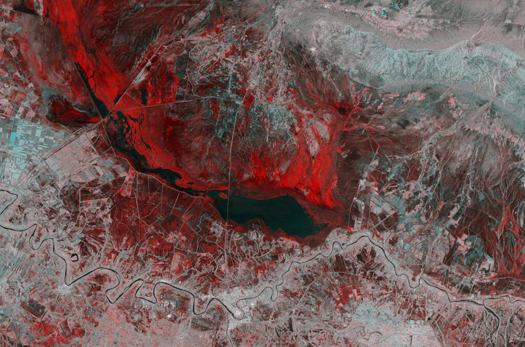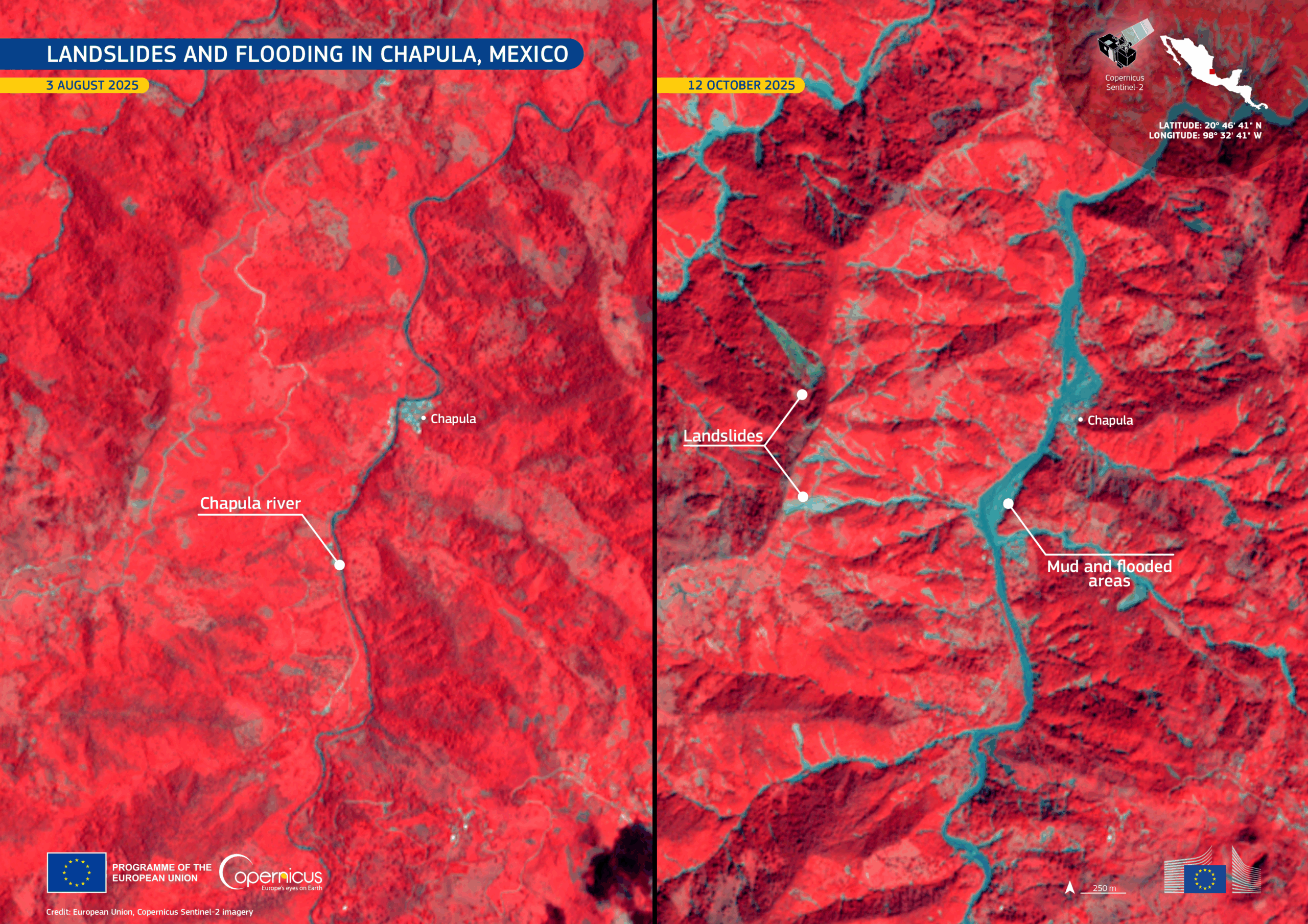
In October 2025, heavy rains from converging tropical storms caused severe flooding across central and eastern Mexico. Local officials report at least 64 deaths and dozens missing, with the village of Chapula among the hardest hit as the Chapula River overflowed, triggering landslides and inundating homes and farmland.
These before-and-after satellite images from Europe’s Copernicus Sentinel-2 mission show the scale of the disaster. In the October 12 image, wide areas shaded in blue mark floodwaters spreading far beyond the riverbanks, covering vegetation (shown in red) that was dry in the August 3 image. Several landslides are also visible.
Freely available data from space and meteorological agencies around the world support disaster management, providing vital information for emergency teams, recovery planners, and communities working to rebuild.
Learn more: https://www.copernicus.eu/en/media/image-day-gallery/devastating-landslides-and-flooding-chapula-mexico