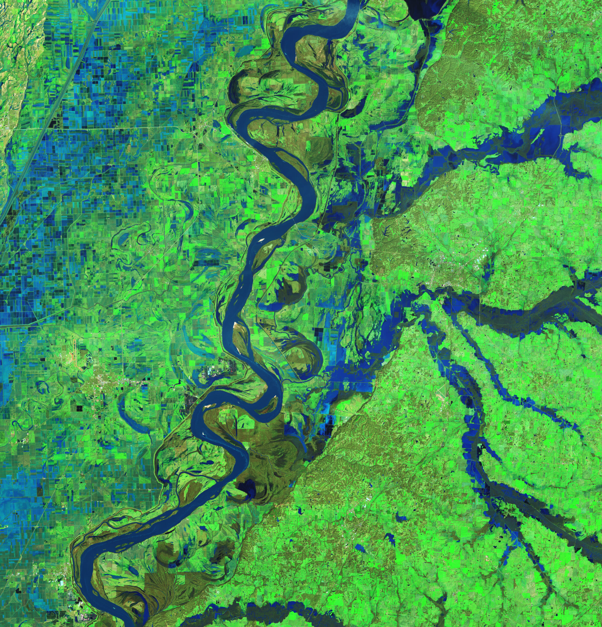
A powerful storm system swept across the U.S. Southeast on February 15-16, bringing torrential rains, damaging winds, and severe flash floods to Tennessee and Kentucky. Some areas received up to 6 inches of rain within 48 hours, causing rivers to rise to moderate and major flood levels. The OLI-2 (Operational Land Imager-2) on Landsat 9 captured false-color images showing swollen rivers and flooded fields in western Tennessee on February 17, highlighting the extent of the flooding compared to images taken in January.
In Tennessee, local authorities declared a state of emergency and ordered mandatory evacuations after a levee failure near Rives, a small town along the Obion River, where more than half of the homes suffered severe water damage. A U.S. Geological Survey water gauge at Obion recorded a water level of 39.8 feet, well above the 34-foot flood stage, prompting officials in nearby Dyersburg to warn residents about possible evacuations as water levels rose on the Forked Deer River.
In western Kentucky, where some of the most destructive flash flooding occurred, cloud cover prevented satellite imagery of the area. Meanwhile, forecasters warned of additional challenges for the flood-stricken region, with a blast of frigid air and an approaching snowstorm expected to bring several inches of snow to areas already impacted by flooding.