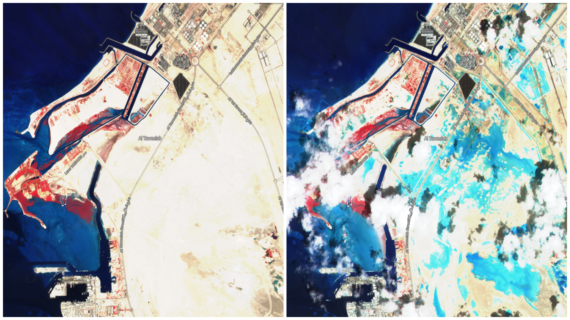
Dubai was affected by floods during second week of April, 2024 due to the heavy torrential rains. The UAE’s National Center for Meteorology reported that eastern parts of the country measured up to 250 millimeters of rain in less than 24 hours. For context, the average rainfall for UAE is estimated to be about 140-200 mm of rainfall per year, whereas for during April month average rainfall for Dubai is estimated to be only 8mm. This extreme amount of precipitation led to submergence of roads, vehicles and disruption of flights. Satellite images are very useful in visualizing the spatial extent and monitoring the flood situation due to their synoptic coverage and temporal revisit. Images acquired from ESA’s Copernicus Sentinel-2 show the pre (05 April, 2024) and post (17April, 2024) flooding changes in part of Al Taweelah, Abu Dhabi, UAE. False color composite from April 17, 2024 shows flooded areas in turquoise, whereas before flooding image of 05 April, 2024 the dry sand in brown color is visible.
More Landsat images showing the flood impact are also available at NASA Earth Observatory HERE

