Regional Perspectives on El Niño Preparedness at Sept 16/17 Meet-ups

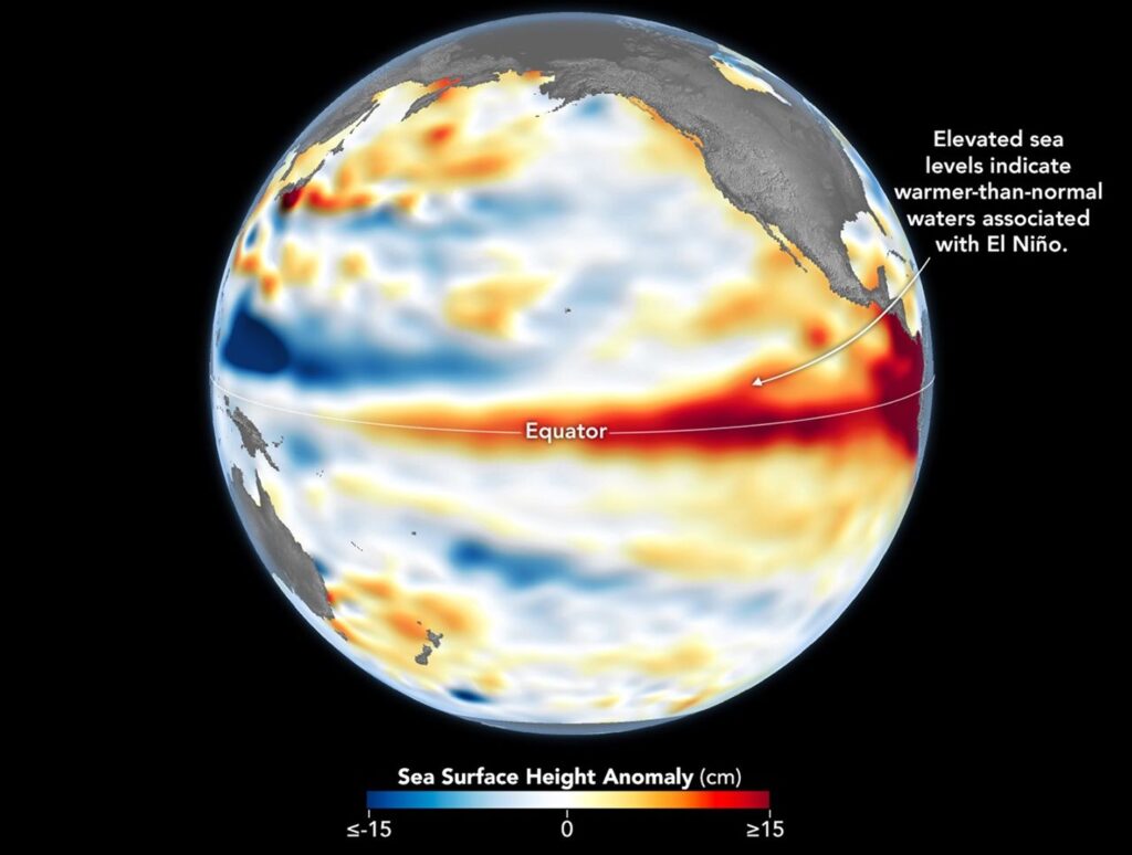
With the ongoing El Niño climate pattern already having an impact on weather around the world, national, regional, and city governments are preparing for potential impacts on food and water security, energy, infrastructure, public safety, and much more.
EOTEC DevNet’s September 16/17 Regional Task Team meetings will explore how decision-makers are using Earth Observation (EO) data to manage potential El Niño impacts such as floods, droughts, and excessive heat. Alignment with the Early Warnings for All (EW4All) initiative will also be a focus, highlighting how agencies are coordinating across sectors to turn remote sensing data into early, localized action.
Confirmed spotlight presentations include representatives of:
- CIIFEN, the Centro Internacional para la Investigación del Fenómeno de El Niño (International Research Center on El Niño
- CBK PAN, the Crisis Information Centre at the Space Research Centre of the Polish Academy of Sciences
- Ministry of Agriculture, Zimbabwe
- National Center for Climate Science Innovation at the Thailand Meteorological Department
- World Food Programme in Asia-Oceania
For the Europe region, where El Niño impacts are less direct, the meeting will look more broadly at “EO for Preparedness.” focusing on user needs and how EO information can be turned into actionable information for preparedness and response. The session will combine a broader European perspective with a concrete use case demonstrating EO in practice.
Across all four regions, the discussions will spotlight practical approaches, lessons learned, and opportunities to adapt good practices to other contexts. Check back here for updates on confirmed presenters.
Meeting Schedule:
- Africa region – September 16 (13:00-14:15 UTC) Agenda
- Americas region – September 16 (16:00-17:15 UTC) Agenda
- Asia-Oceania region – September 17 (04:00-05:15 UTC) Agenda
- Europe region – September 17 (13:00-14:15 UTC) Agenda
Need a calendar invitation? If you are already registered, you will automatically receive one. If not, visit this page to register. We will send you an invite with a teleconference link.
Why Should You Attend?
- Networking: Engage with regional and global experts in Earth Observation.
- Resource Identification: Discover new tools, data, and training resources.
- Capacity Building: Contribute to identifying and addressing gaps in regional and global Earth Observation capacity.
- Collaboration: Connect with potential partners for projects and initiatives.
We look forward to your participation and contributions to these vital discussions that shape the future of Earth Observation capacity building.
IMAGE: Higher-than-normal sea surfaces (red) are visible in the central and eastern Pacific on June 8, 2026, a few days before El Niño was declared. Data for the map were acquired by the Sentinel-6 Michael Freilich satellite and processed by scientists at NASA’s Jet Propulsion Laboratory (JPL). Credit: NASA Earth Observatory/Lauren Dauphin