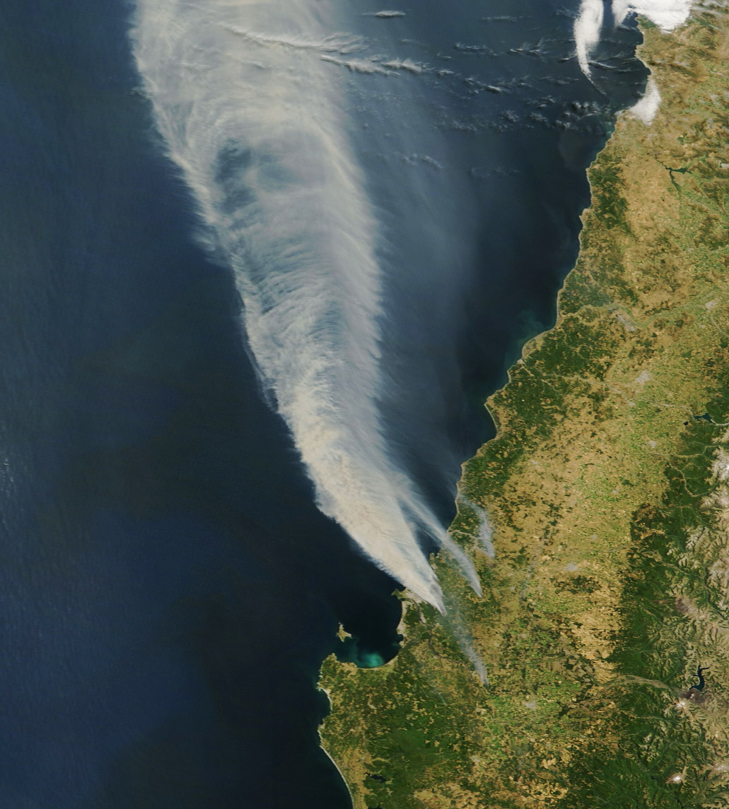
Wildland fires broke out amid hot and dry conditions in south-central Chile in mid-January 2026, prompting evacuations and causing extensive damage to infrastructure. As of January 20, the spate of deadly fires had burned more than 30,000 hectares (74,000 acres) in the country’s Biobío and Ñuble regions, according to Chile’s National Forestry Corporation.
The MODIS (Moderate Resolution Imaging Spectroradiometer) instrument on NASA’s Terra satellite captured this image of smoke billowing from multiple fires on January 18. Dozens of active fires in the area prompted the evacuation of 50,000 people and destroyed more than 300 homes, according to a January 19 report from Chile’s U.N. Resident Coordinator’s Office. Aerial and ground-based photographs showed neighborhoods in Concepción charred in the aftermath.
More: science.nasa.gov/earth/earth-observatory/fires-erupt-in-south-central-chile/