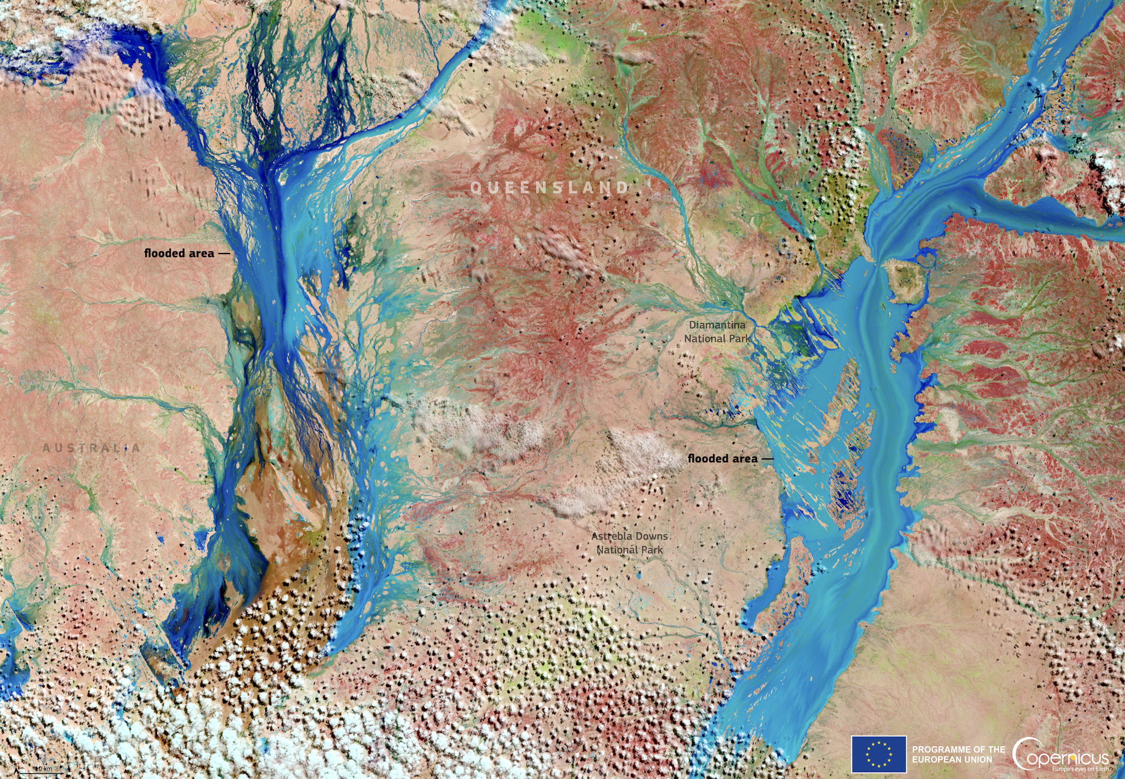
In late March 2025, the Australian state of Queensland was affected by severe flooding, with some regions receiving over a year’s worth of rainfall in a matter of days. Areas in western Queensland recorded the worst level of flooding in 50 years, leading to significant infrastructural damage, road closures, livestock losses, and the evacuation of residents from remote and rural communities.
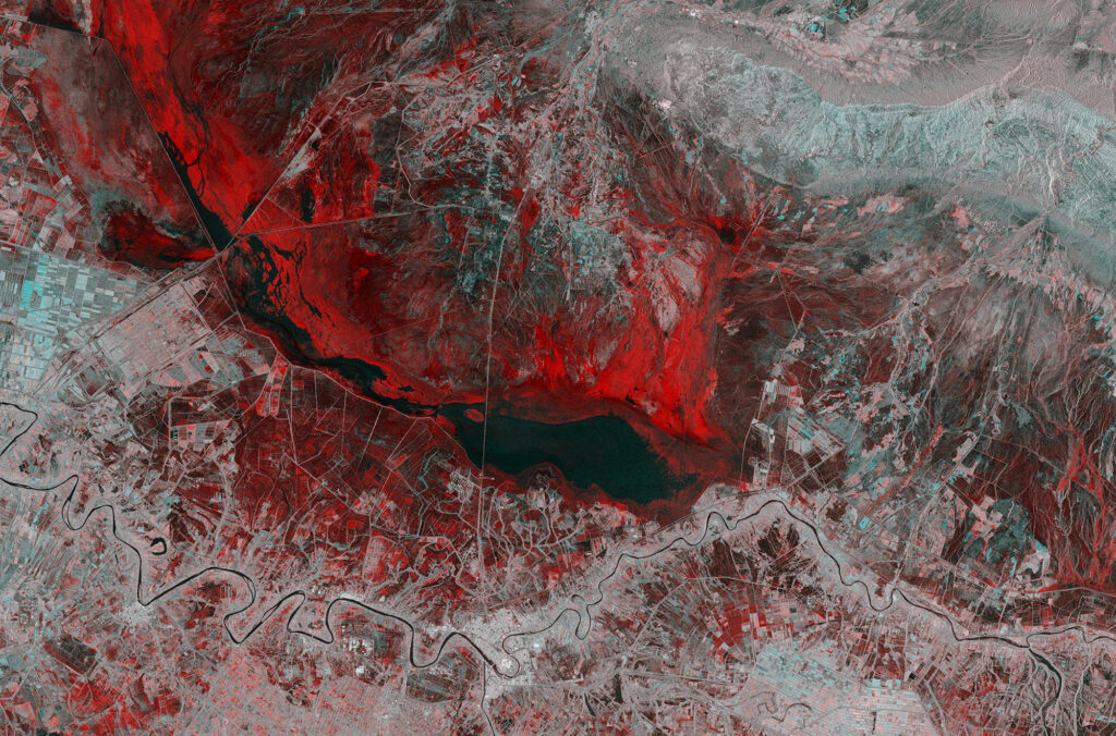
In this Copernicus Sentinel-2 image acquired on 29 March 2025, flooded areas in parts of western Queensland, near the Diamantina and Astrebla Downs National Parks, are shown in blue. The inundated landscape reflects the scale of the disaster, with swollen rivers and waterlogged plains spreading across vast stretches of terrain. Satellite imagery like this plays a crucial role in monitoring flood extent, informing response strategies, and supporting environmental and agricultural recovery efforts.